Google Navigation Challenge 2. Prudhoe Bay - Ushuaia

Archive for the three above subforums
Post Reply
User avatar
tommykl
Posts: 7073
Joined: 07 Apr 2010, 17:10
Location: Banbury, Oxfordshire, UK

Re: Google Navigation Challenge 2. Prudhoe Bay - Ushuaia

Post by tommykl »

Thomas De Bock wrote:Prudhoe Bay - Ushuaia Challenge - day 11: La Mancha to Paso Hondo

After the oddly relaxing sleep in a bamboo hut, we got up early for our dash towards Guatemala. We could reach Guatemala within ten hours, but not any hotel, and any Northern route would either cut it too short or be stifled by the intensely annoying Chixoy River. To top it off, the organisers were still very annoying with their regulations. When we drove back towards the highway, we couldn't cross directly and turn left. No. We had to turn right and go the opposite way. We came across another intersection where we weren't allowed to U-turn, as clearly said by the "NO U-TURN" sign featuring the race's logo. We turned off, headed down the road and looped around the first block we could find before heading back towards the highway where, for some unknown reason, we were allowed to turn left...

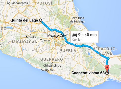
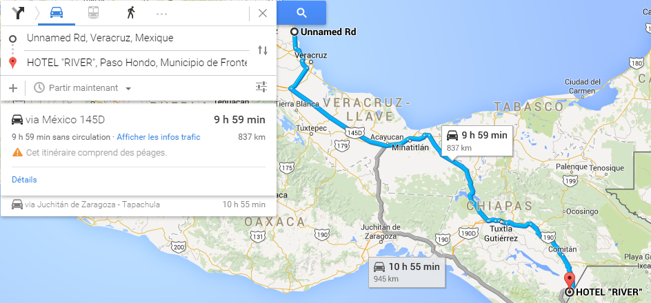
We continued South towards the resort city of Veracruz, passing through Ursulo Galvan and José Cardel. For some reason, the Mexicans don't only name their towns with the surnames of their heroes, but their forenames as well. We didn't remember passing through George Washington, Montana... Either way, we never actually reached Veracruz. We turned South a bit before it, towards the Pacific Ocean. This route was slightly longer on sheer length, but considering our allowance of 10 hours, would hopefully get us to Colon in first place.

We didn't completely cross the isthmus, though, but we certainly left the coastline...for a while. Soon enough, we were nearing the Gulf again, with Coatzacoalcos, a city which, for an unexplainable reason, sounded like those Flemish girls might want to stay there. We hadn't seen them since Deadhorse. In fact, we hadn't seen anyone since Tok, aside from the Voecklers. Truth be told, we're hoping to not be a day ahead of everyone come Colon, to have some company on the ferry to Cartagena...

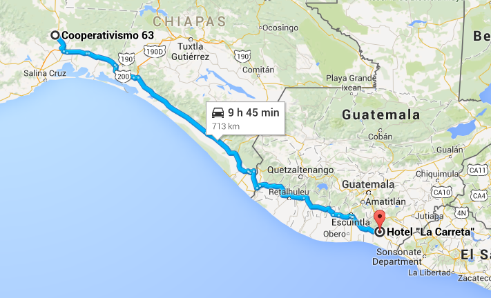
This was the day's halfway mark, and we definitively turned South towards Tuxtla Gutiérrez. We crossed a bridge over a lake that I won't even try to spell, much less pronounce, before reaching the city that featured the start of almost all Carrera Panamericana races. We'd essentially done it backwards, and starting from a bit further up North... But the day didn't end there. We continued due South East towards the border with Guatemala. We hoped to reach the border town of Ciudad Cuauhtémoc, but it was soon apparent we'd have to bail. We took the last possible escape route, Paso Hondo, and stopped at the brilliantly named Hotel "RIVER". Oh, the anticipation...


http://www.formularejects.com/uploader/ ... /leg11.png

Staying at HOTEL "RIVER", 1° Avenida Sur Ote, Paso Hondo, Municipio de Frontera Comalapa, Chiapas, Mexico

Route details: Just off Highway 180, km 31, La Mancha-Actopan - 1° Avenida Sur Ote, Paso Hondo.

4 days 10 hours 18 minutes total driving time
9726 kilometres total distance
kevinbotz wrote:Cantonese is a completely nonsensical f*cking alien language masquerading as some grossly bastardised form of Chinese

Gonzo wrote:Wasn't there some sort of communisim in the East part of Germany?
User avatar
Bobby Doorknobs
Posts: 4059
Joined: 30 Jul 2014, 17:52
Location: In a safe place.

Re: Google Navigation Challenge 2. Prudhoe Bay - Ushuaia

Post by Bobby Doorknobs »

Day 11
Start: Hotel Plaza Venecia, Carr. Panamericana 60, Centro, 76800 San Juan del Río, Qro., Mexico
Finish: Hilton Villahermosa & Conference Center, Medellín y Pigua 2da. Sección, 86280 Villahermosa, Tab., Mexico
Distance Traveled: 919 km
Time Traveled: 9h 37m
Total Distance: 9268 km
Total Time: 4d 7h 17m

Anthony Byrne wrote:We bypassed Mexico City (which is in Mexico) today as we made our way towards the Guatemalan border. Tomorrow we can say goodbye to Mexico and spend a few days travelling through Central America with one goal in sight: Colón, Panama, after which it was off for one long-ass trip through South America. We stopped for the night at Villahermosa International Airport, where there is a hotel. I've never slept anywhere near an airport before. I just hope I don't need earmuffs...
#FreeGonzo
User avatar
Shadaza
Posts: 2769
Joined: 05 Jun 2009, 23:49

Re: Google Navigation Challenge 2. Prudhoe Bay - Ushuaia

Post by Shadaza »

Image

Quinto del Lago to Juchitán de Zaragoza.

The journey is long, the journey is hard, no ragrets.
Message me on Discord.
User avatar
Peteroli34
Posts: 1957
Joined: 25 May 2013, 10:01
Location: Thurrock, Which isn't London

Re: Google Navigation Challenge 2. Prudhoe Bay - Ushuaia

Post by Peteroli34 »

Day 11

Start:Hotel Monterreal Cristobal Colon 970 ote Las Vegas 80090 Culiacan, SIN Mexico
Finish: Quality Inn Horizon Morelia, Morelia, Mexico
Distance Traveled: 605 Miles
Time Traveled: 10h
Total Distance:5572 Miles
Total Time: 104h 15M

Image

Day 11 and we continue our trip through Mexico we have to try and close the gap if we have any chance of not being last in the race. Progress is good today towards Mexico City. Time starts to run out as we look for accommodation in Morelia we found somewhere just as we park up dead on the time limit, We need good fortune to catch up though maybe the De Bocks and Voeckler's will get into a fight or that Mike fellow will annoy a drug cartel.
User avatar
Samster
Posts: 1658
Joined: 02 Feb 2010, 20:27
Location: Newark, England
Contact:

Re: Google Navigation Challenge 2. Prudhoe Bay - Ushuaia

Post by Samster »

Leg 11 San Juan Del Rio - Villahermosa (Mexico Sucks Edition) https://www.google.co.uk/maps/dir/Holid ... !3e0?hl=en

I had intended on a more southerly route into Guatemala but once again found myself stuck in an area with no hotels at the end of the ten hours so had to go off the ideal planned route and instead found a Hilton of all things in the middle of nowhere on 186 just past Villahermosa. Whats more, it seems we have found the Irish team there! Hope this doesn't prove too costly as it looks like we will have to take some smaller roads to make it back onto the main road through Guatemala.
User avatar
Shadaza
Posts: 2769
Joined: 05 Jun 2009, 23:49

Re: Google Navigation Challenge 2. Prudhoe Bay - Ushuaia

Post by Shadaza »

The trials of the race are wearing on as Mexico is proving more sapping than many anticipated. V8fan has officially pulled out of the running, fearing he won't make it to Colon in time, whilst a couple of competitors have yet to log their 11th legs. Regardless. Leg 12 is now open.

Even with the field spread out, Samster and Simtek managed to share a hotel. Everyone is still in Mexico, though the front teams well be long gone out of it by end of the next leg!

https://www.google.com/maps/d/edit?mid= ... ues3h3pOJ0
Message me on Discord.
User avatar
Shadaza
Posts: 2769
Joined: 05 Jun 2009, 23:49

Re: Google Navigation Challenge 2. Prudhoe Bay - Ushuaia

Post by Shadaza »

Leg 12.

Image

End: Hotel La Carreta, CA2, Guatemala

Country number 4, Guatemala! I had hoped to blitz past it in one day, but the hotel seems nice enough to stop in. Hopefully I shall be through El Salvador swiftly with renewed vigor.
Message me on Discord.
User avatar
Peteroli34
Posts: 1957
Joined: 25 May 2013, 10:01
Location: Thurrock, Which isn't London

Re: Google Navigation Challenge 2. Prudhoe Bay - Ushuaia

Post by Peteroli34 »

Day 12

Start:Quality Inn Horizon Morelia, Morelia, Mexico
Finish: Hotel Madan Cardenas, Pueblo Nuevo, Cárdenas, Mexico
Distance Traveled: 616 Miles
Time Traveled: 9h 57M
Total Distance:6188 Miles
Total Time: 114h 12M

Image

Day 12 sees as skirt around Mexico City as we cross the width of Mexico. We're starting to Zig Zag across the county our challenge today is to try and close the gap to the teams in front if we can make Colon at the same time of at least one other team we have a chance of not finishing stone dead last. Unlike those Canadians we wont quit just because we are not winning. The clock begins to run out in Cardenas we end up just 3 minutes short of the 10h limit hopefully up ahead other teams are struggling to reach the 10h limit
User avatar
the Masked Lapwing
Posts: 4204
Joined: 10 Sep 2010, 09:38
Location: Oran Park Raceway

Re: Google Navigation Challenge 2. Prudhoe Bay - Ushuaia

Post by the Masked Lapwing »

Leg 12
Start: Hotel Arcos Del Parque, Calle Miguel Hidalgo 804, Centro, 96000 Acayucan, Ver., Mexico
Finish: Hotel Carolinas Resort, km. 152 carretera al pacifico, san bernardino, suchitepequez, Guatemala, CA2, Guatemala
Distance: 699 km (total 10,100 km)
Time: 9 hrs, 10 mins (total 4 days, 17 hrs, 53 mins)

Image

A mad and slightly old Australian man wrote:I trapped myself on my route. In my quest for privacy, I put myself in a position where I either let 50 minutes get wasted on the faster route or commit myself to the slower.
Could be worse.
Could have someone else in the car.
R.I.P.
GM HOLDEN
1948-2017
User avatar
DemocalypseNow
Posts: 13185
Joined: 17 Aug 2009, 09:30
Location: Lost, send help
Contact:

Re: Google Navigation Challenge 2. Prudhoe Bay - Ushuaia

Post by DemocalypseNow »

Sorry this is late, I spent much of yesterday in hospital and the sedatives didn't fully wear off until I slept them off last night.

LEG 11
Frederic-Maxime Voeckler wrote:Even though we only have to arrive in Colon on the same day as the De Bocks, we want to regardless. I think we have a chance though. We are pushing hard, and unlike them, start our day straight away on the flat, fast interstate. It's admittedly a somewhat boring route, but it's surely a faster one. We charged down the road at the speed limit (which is basically as fast as our Renault Trafic is capable of going).

Then came the big decision - go east, or head south? We chose the latter, and our target was the Mexican border town of Tapachula. It was going to be extremely tight for time, but I wanted to be the first to Colon, and there is no fun in this without risk!

It was a big risk, because we kept getting fluctuating traffic reports. Half the time, we were short of our destination by a few minutes, the rest we were scraping in. Luckily, the gods were on our side today. The reported traffic at Huehuetan, on the way into the city, failed to materialise, and we were clear to press on to our hotel on the edge of town, the Hotel Loma Real.

Voeckler Leg 11 Map

LEG 12
Jeremy-Etienne Voeckler wrote:Having taken the day off driving duties to sip on some nice cool bottles of Corona the day before, it was my turn to take the wheel. Freddy was sure ambitious with his hotel choices, so with myself at the controls, I decided to take a more relaxed approach to the day. I sat back and enjoyed the drive through Guatemala, and we were able to go from one end of the country to the other in under 8 hours. Not a very big place is it?

I settled at a northern city centre hotel in San Miguel. We still had almost half an hour on the clock, but I was happy to settle here, rather than attempt a mad dash to some obscure hotel further down the road and out of the city. Though I'm much less competitive in this even than Freddy appears to be, I do still wonder what kind of sneaky route the De Bocks cracked to try and defeat us...it will be interesting to see which of us makes the ferry first.

Team Voeckler's Leg 12 Map
Novitopoli wrote:Everytime someone orders at Pizza Hut, an Italian dies.
Novitopoli wrote:Juve's Triplete: Calciopoli, doping & Mafia connections.

Image Image
User avatar
Samster
Posts: 1658
Joined: 02 Feb 2010, 20:27
Location: Newark, England
Contact:

Re: Google Navigation Challenge 2. Prudhoe Bay - Ushuaia

Post by Samster »

Leg 12 Villahermosa - San Jeronimo https://www.google.co.uk/maps/dir/Hilto ... !3e0?hl=en

Guatemala is much easier for hotels than Mexico! Who'd have thought? Anyway today left us with two choices, backtrack a bit to Villahermosa itself and head back to the main road into Guatemala or continue on the smaller roads around this National Park in the far south-east of Mexico. The GPS suggested the latter would be quicker and from where we were was more direct plus we would get to avoid Guatemala City (another imaginatively named capital). Despite again ending up in a rather rural area at the end of our stint, there were plenty of hotels to choose from and we stayed in the small town of San Jeronimo. Hopefully we will have shaked those pesky Irish now. :P
User avatar
WaffleCat
Posts: 2293
Joined: 08 Jan 2012, 13:02
Location: Singapore

Re: Google Navigation Challenge 2. Prudhoe Bay - Ushuaia

Post by WaffleCat »

LEG 11

Start: Quinta del Lago, Corea, Santiago de Querétaro, Qro., Mexico
End: Casa Grande, Blvd. Cooperativismo, 63, 70380 Lagunas, Oaxaca, México
Leg Time: 9hr, 34 mins
TOTAL TIME: 4 days, 8 hours, 25 minutes

You may remember yesterday, Mike tried his best to repair the air-conditioning. We went to the car to test it out. Mike did a horrible, horrible job.

Instead of cooling us down, the air-conditioner was now essentially a heater.

Well done Mike, you've somehow changed physics.

Only someone as inept as him can do that.

However, the rest of the day was unexciting, partly thanks to our sour mood at our un-air-conditioner. We just followed the team staying with us to our next destination. We were ahead of some teams, behind others. Oh well.
---------------------------------------------
LEG 12

Start: Casa Grande, Blvd. Cooperativismo, 63, 70380 Lagunas, Oaxaca, México
End: Hotel "La Carreta", CA2, Chiquimulilla, Santa Rosa, Guatemala
Leg Time: 9 h 45 mins
TOTAL TIME:4 days, 18 hours, 10 minutes

Lagunas

Mike wanted to fix his air-conditioning calamities from yesterday. I just said no. He'll probably get the air-conditioner to spew fire if he even touched it again. I just got the friendly people of Lagunas to help me, and within minutes the problem was fixed. Mike went to get an ice cream while we were toiling away has his improvised piece of work. I grabbed an ice pack in case Mike were to ever tamper with the car again.

Ciduad Tecun Uman

Mike was near naked.

Mike was complaining it was too hot.

In actuality, he only understood the word 'strip' in Spanish, so proceeded to get ready for a strip search.

All they asked him to do was to stop at the rumble strips at the border to conduct a check.

Mike is such an oaf.

Escuintla

Mike wanted a resort. Mike said that he wants a day of relaxation at an actual beachfront resort to just chill out, kick his feet back, and relax. That's what you've been doing all the time in the car while I'm driving, Mike. I asked him about our previous hotels, at Jimenez or at Quinta de Lago.

He said the first one was a pool, not a beach. And he spent the entirety of the second hotel's stay either f***ing up the air-conditioning or dead. Still no excuse. If we wants to survive, he needs to live without being dead or uncooperative with cooling devices. We pushed on, not towards the coast

Hotel "La Carreta"

The quotation marks are a bit sketchy.

The same team somehow traveled with us for three straight legs, at a point where every other time is probably miles away from each other right now. Mike thought of an idea. He approached them for an alliance. Mike returned, shaken. I don't know if they said yes or no, which makes me even more worried about Mike's reaction.

Whatever it was, we were going to press on tomorrow into, and probably through El Salvador, and see where we come out on the other side. Will we make it to Colon alongside the three leaders? Will we be stuck on the jetty, waving our fists at them while they cackle into the sunset? Only time will tell.
---------------------------------------

Sorry for not posting leg 11, I had planned to post it but the first great forum crappage of GP Rejects happened.
Last edited by WaffleCat on 23 Apr 2015, 09:31, edited 1 time in total.
My friend's USB drive spoiled, spilled tea on her laptop and had a bird poo in her hand.

What did she do in her past life to deserve this?

Signup for the Random Racing League, Season TWO!!!
User avatar
Nuppiz
Site Donor
Site Donor
Posts: 5935
Joined: 30 Mar 2009, 12:10
Location: Vantaa, Finland
Contact:

Re: Google Navigation Challenge 2. Prudhoe Bay - Ushuaia

Post by Nuppiz »

Leg 12
Start: Hotel Esteros, Central Norte 12, Centro, 30540 Pijijiapan, Chis., Mexico
Finish: Flowers Hotel Inn, San Vicente, El Salvador
Distance: 655 kilometres (407 miles)
Time: 9 hrs 56 mins

Total distance: 10010 kilometres (6220 miles)

Image

Nathan Nurmester wrote:Day 12. Today we finally left Mexico behind and headed east. The border control was much easier than on the US-Mexican border so we didn't have to waste much time getting our papers checked. We went through Guatemala and found out that there was more than enough time to press on to El Salvador. Border control was quite smooth again although Nikolai nearly had his vodka bottle confiscated, not because it was illegal but because the border guard wanted it for himself. After that was sorted we continued driving, passing many small towns along the way. We finally pulled off to a cozy hotel just a short distance from the Carretera Panamericana, about halfway through the country. I checked the clock and we only lost four minutes of efficient travelling time which is quite good considering the country we're in. It turns out that we've now officially travelled for more than ten thousand kilometres on this journey. And we're not even halfway through yet!
Eurosport broadcast for the 1990 Mexican GP prequalifying:
"The Life, it looked very lifeless yet again... in fact Bruno did one, slow lap"
User avatar
Bobby Doorknobs
Posts: 4059
Joined: 30 Jul 2014, 17:52
Location: In a safe place.

Re: Google Navigation Challenge 2. Prudhoe Bay - Ushuaia

Post by Bobby Doorknobs »

Day 12
Start: Hilton Villahermosa & Conference Center, Medellín y Pigua 2da. Sección, 86280 Villahermosa, Tab., Mexico
Finish: Hotel y Restaurante La Fuente, Morales, Guatemala
Distance Traveled: 652 km
Time Traveled: 9h 47m
Total Distance: 9920 km
Total Time: 4d 17h 4m

Anthony Byrne wrote:For the first time in about a week we were sharing a hotel with another team. It was the same team we had followed the day before. Nice bunch. We were following them again today, at least until the Tabasco-Chiapas border, where we went our separate ways again. They took a southbound route that would probably have taken them to the coast, where there were more developed roads. We decided to head east, which would take us through the centre of Guatemala, and it was good going. In fact, we've almost crossed the whole country already. Alas, we did not and we stopped about an hour from the border with Honduras in Morales.
#FreeGonzo
User avatar
Nessafox
Site Donor
Site Donor
Posts: 6228
Joined: 30 Nov 2009, 19:45
Location: Stupid, sexy Flanders.

Re: Google Navigation Challenge 2. Prudhoe Bay - Ushuaia

Post by Nessafox »

Leg 12:


We overslept a little bit today. The hot Mexican sun is killing. Altough i did get to bronze nicely. I bet those Irish guys look all red now. I doubt they have ever even experiencied sunlight.
The road: forests, a lake. Somewhat past half, we almost reached the Pacific ocean. After about 8 hours we finally got out of this country!
So now we entered Guacemole. Eh Guatemala. Funny name. We settled in the Hotel Carolinas Resort. With an hour to spare, but we really coulnd't find anything better on the map. When we entered, we constantly heared to word 'mate'. That means there had to be some Australians in the hotel. And indeed there were. Who'd have thought to find familiar faces in Guacemale. It's good to know we're not last. Still, it's going to be close, as the traffic in Costa Rica and Panama will be insane. Tomorrow, we will likely pass the 10000 km mark! And mom, you can take of that ridiculous sombrero already! We're in Guatemole now!


Start: Hotel Madrid, Minatitlan - Coatzacoalcos Km 264, Nueva Mina, 96760 Minatitlan, Ver., Mexico
Finish: Hotel Carolinas Resort, km. 152 carretera al pacifico, san bernardino, suchitepequez, Guatemala, CA2, Guatemala
Distance Traveled: 720 km
Time Traveled : 9h 6m
Total Distance: 9944 km
Total Time: 4d 18h 30m

Image
I don't know what i want and i want it now!
User avatar
Shadaza
Posts: 2769
Joined: 05 Jun 2009, 23:49

Re: Google Navigation Challenge 2. Prudhoe Bay - Ushuaia

Post by Shadaza »

Unfortunately I had to work late today and tomorrow too, so there will be no maps.

But everyone seems to be working there way down Guatemala - El Salvador and all everyone can talk about is who will make that crucial first boat.

Leg Lucky 13 is open, sail safe.
Message me on Discord.
User avatar
Bobby Doorknobs
Posts: 4059
Joined: 30 Jul 2014, 17:52
Location: In a safe place.

Re: Google Navigation Challenge 2. Prudhoe Bay - Ushuaia

Post by Bobby Doorknobs »

#FreeGonzo
User avatar
Samster
Posts: 1658
Joined: 02 Feb 2010, 20:27
Location: Newark, England
Contact:

Re: Google Navigation Challenge 2. Prudhoe Bay - Ushuaia

Post by Samster »

Leg 13 Salama, Guatemala to Villaneuva, Nicaragua https://www.google.co.uk/maps/dir/Hotel ... !3e0?hl=en

What a stint, we ended up driving in no less than four countries today, our route turned out to be a great one as we got to avoid all the capital cities in Guatemala, El Salvador and Honduras. We followed Route 3 all the way through El Salvador, quickly got through the little bit of southern Honduras and making it into Nicaragua with an hour to spare. To complete our luck we even managed to find a random hotel in the middle of nowhere outside the small town of Villaneuva, right at the end of our ten hours. :D
User avatar
Bobby Doorknobs
Posts: 4059
Joined: 30 Jul 2014, 17:52
Location: In a safe place.

Re: Google Navigation Challenge 2. Prudhoe Bay - Ushuaia

Post by Bobby Doorknobs »

Day 13
Start: Hotel y Restaurante La Fuente, Morales, Guatemala
Finish: Hotel Chalet, Antiguo Cine Nancy, Avenida Central, Estelí, Nicaragua
Distance Traveled: 634 km
Time Traveled: 9h 37m
Total Distance: 10554 km
Total Time: 5d 2h 41m

Anthony Byrne wrote:Our continued adventures through the Central American interior saw us cross the entire Republic of Honduras and into Nicaragua, where we are going to make a run for the Pacific coast, though this may end up taking us through Managua. We'll decide in the morning.
#FreeGonzo
User avatar
Peteroli34
Posts: 1957
Joined: 25 May 2013, 10:01
Location: Thurrock, Which isn't London

Re: Google Navigation Challenge 2. Prudhoe Bay - Ushuaia

Post by Peteroli34 »

Day 13

Start:Hotel Madan Cardenas, Pueblo Nuevo, Cárdenas, Mexico
Finish: Filadelfia Coffee Resort & Tours, Antigua Guatemala, Sacatepequez, Guatemala
Distance Traveled: 458 Miles
Time Traveled: 10H
Total Distance:6646 Miles
Total Time: 124h 12M

Image

Day 13 and today we leave Mexico the last team to do so i presume. Our journey today is occupied by trying to find ways to delay the ferry departure by a day. A bomb threat on the ferry maybe? Get someone to sink it in port you can pay someone to do that right. We are so preoccupied trying to think of schemes we aint looking at the time. Luckily we find somewhere with a few seconds to spare. We don't want to be disqualified would we we have a ferry to sink
User avatar
Nessafox
Site Donor
Site Donor
Posts: 6228
Joined: 30 Nov 2009, 19:45
Location: Stupid, sexy Flanders.

Re: Google Navigation Challenge 2. Prudhoe Bay - Ushuaia

Post by Nessafox »

Leg 13:

Yeah, those australians are defenitely mad! Some local villager we met invited both teams to go fishing on the Rio Ixtacapa. I caught more fish than both of them together, but they ate more than both of use together. The world is not fair! The roads were straight because we were near the coastline, but they didn't progress a lot. Still we're better of than the people currently in the mountains. The region is a bit swampy, so lots of mosquitos. What can i say, my blood is delicious? Before we knew it we were exiting Guantanamera, eh, Guatemala.El Salvador seemed to be a lot more urbanised, compared to what we've seen before. Some familiar city names like Lourdes and Armenia. Mom was already worried that we were lost in the Caucasus. Anyway, it inspired us to put a Soad-album on the speakers, which give us some extra energy. We then passed Santa Tecla, San Salvador (orginal capital!) and Ilopanga. After that, the road became a bit more mountainous, but there were still lots of villages along this road, and San Miguel was a big city too. Yeah, we like El Salvador better! We weren't looking forward to entering Honduras. That country got a reputation more nasty then Mexico and Colombia combined... We got very close to the Pacific Ocean for the second time today. Smelling the sea is defenitely great after spending so much time in the Mexican desert. Hm, Mexican desserts! Lot of shady people on the road, do we really have to sleep here? What is that there? Another country?!?!? Wow... Thankfully there was a hotel, in the frontier city of Somotillo, with the original name Hotel Fronteras. Tomorrow we're heading to Costa Rica and the day after to Panama. It's going to be very close to make it on the same day as the leaders. I hope they make some mistakes. I wonder if anyone went trough Belize though...


Start: Hotel Carolinas Resort, km. 152 carretera al pacifico, san bernardino, suchitepequez, Guatemala, CA2, Guatemala
Finish: Hotel Fronteras, NIC-24, Somotillo, Nicaragua
Distance Traveled: 650 km
Time Traveled : 9h 52m
Total Distance: 10594 km
Total Time: 5s 4h 22m

Image
I don't know what i want and i want it now!
User avatar
HawkAussie
Posts: 1110
Joined: 21 Nov 2012, 04:59
Location: Tasmania

Re: Google Navigation Challenge 2. Prudhoe Bay - Ushuaia

Post by HawkAussie »

I am going to retire from this race, as I don't reckon I will make it the Colon Ferry in time. Good Luck to the rest of the teams left remaming.
Officially Retired
User avatar
Nessafox
Site Donor
Site Donor
Posts: 6228
Joined: 30 Nov 2009, 19:45
Location: Stupid, sexy Flanders.

Re: Google Navigation Challenge 2. Prudhoe Bay - Ushuaia

Post by Nessafox »

Maybe i can still win 'by default' :dance:
I don't know what i want and i want it now!
User avatar
the Masked Lapwing
Posts: 4204
Joined: 10 Sep 2010, 09:38
Location: Oran Park Raceway

Re: Google Navigation Challenge 2. Prudhoe Bay - Ushuaia

Post by the Masked Lapwing »

Leg 13
Start: Hotel Carolinas Resort, km. 152 carretera al pacifico, san bernardino, suchitepequez, Guatemala, CA2, Guatemala
Finish: Hotel Fronteras, NIC-24, Somotillo, Nicaragua
Distance: 650 km (total 10,750 km)
Time: 9 hrs 52 mins (total 5 days, 3 hrs, 45 mins)

Image
R.I.P.
GM HOLDEN
1948-2017
User avatar
WaffleCat
Posts: 2293
Joined: 08 Jan 2012, 13:02
Location: Singapore

Re: Google Navigation Challenge 2. Prudhoe Bay - Ushuaia

Post by WaffleCat »

LEG 13

Start: Hotel "La Carreta", CA2, Chiquimulilla, Santa Rosa, Guatemala
End: Hotel Yeland, NIC-52, Puerto Sandino, Nicaragua
Leg Time: 9hr 53 mins
TOTAL TIME: 5 days, 4 hours, 3 minutes

San Miguel, El Salvador

We had been driving for a few hours, basically nothing has happened as of yet. We stopped at a nearby restaurant to grab a quick lunch. Mike ordered steak.

I ordered iguanas. Mike had no idea what those were, so he didn't mind a try.

Thank goodness the steak came first. Mike lost his appetite and left the restaurant soon after. Without paying. I'm going to get my machete in the trunk to get him to pay me, that meal was bloody expensive and I have almost no money on me.

Goascoran

We already made it past El Salvador. Damn, that was quick. I decided to fill up near the border. Mike was bored, so he decided to juggle a football. Not bad I admit.

But you're doing that at the El Salvador-Honduras border.

They had a war over a football game in the past.

I stopped refuelling halfway to prevent any further international incidents from occurring.

El Tamarindo

This was a mistake.

We continued past Leon to go on a search for hotels down the road. Mike was kind of worried being away from safe, big cities. Bugs might enter our hotel room, Mike said. I was worried too. There was no sign of civilisation.

An intersection came upon us. I was determined to head further west. Mike said to turn here towards the beach. I asked why.

"We could go to a beach resort!"

That is the world's first dumb-smart comment ever. A comment both idiotically stupid yet ingeniously smart.

We headed towards the beach for a while. A small town appeared out of nowhere, I instinctively turned off there, Mike went to grab suntan lotion and a towel, and I pulled up into our hotel.

It wasn't a resort. It was just a regular hotel. Mike was thoroughly disappointed. I wasn't. We may just have an advantage here.
My friend's USB drive spoiled, spilled tea on her laptop and had a bird poo in her hand.

What did she do in her past life to deserve this?

Signup for the Random Racing League, Season TWO!!!
User avatar
DemocalypseNow
Posts: 13185
Joined: 17 Aug 2009, 09:30
Location: Lost, send help
Contact:

Re: Google Navigation Challenge 2. Prudhoe Bay - Ushuaia

Post by DemocalypseNow »

Frederic-Maxime Voecker wrote:One day to go! I hope? I don't know. Rumours are the traffic is utterly horrendous in Costa Rica and will stop us from reaching Colon before the sun sets on Day 14.

The days are becoming uneventful from a navigation point of view. Our last major decision was whether to follow the Pan-American Highway all the way to Panama City, or try and gain time by using a different route through Costa Rica. Because of the horror stories about crawling traffic, we exited the fabled highway in Honduras, and followed the west coast roads through Nicaragua, so that we would be avoiding the main highway that runs straight through San Jose the next day.

In the end, we made it to a town called Canas, and a hotel named, straightforwardly enough, Hotel Canas. Does what it says on the tin, I guess.

We lost about a quarter of an hour to traffic today. I imagine that will pale into comparison to our losses tomorrow.


Team Voeckler's Leg 13
Start: Drive Inn Milians, San Miguel, El Salvador
Finish: Hotel Cañas, Cañas, Costa Rica
Novitopoli wrote:Everytime someone orders at Pizza Hut, an Italian dies.
Novitopoli wrote:Juve's Triplete: Calciopoli, doping & Mafia connections.

Image Image
User avatar
Peteroli34
Posts: 1957
Joined: 25 May 2013, 10:01
Location: Thurrock, Which isn't London

Re: Google Navigation Challenge 2. Prudhoe Bay - Ushuaia

Post by Peteroli34 »

With all these people quitting because they are bot winning i might end up finishing second :D
User avatar
tommykl
Posts: 7073
Joined: 07 Apr 2010, 17:10
Location: Banbury, Oxfordshire, UK

Re: Google Navigation Challenge 2. Prudhoe Bay - Ushuaia

Post by tommykl »

Sorry about failing to post yesterday, I had quite a lot of coursework I needed to do... It seems like competition is dwindling!

Thomas De Bock wrote:Prudhoe Bay - Ushuaia Challenge - day 12: Paso Hondo to Sensuntepeque

Judging from the map of where everyone is staying, we should have left the Gulf of Mexico much sooner. The Voecklers would likely beat us to Colon, but we were expecting to reach it in the top three, and more importantly, on the same day. We'd get a clearer picture in Costa Rica, we thought.

In the meantime, we had to cross Guatemala and its towns with names even harder to pronounce than those in Mexico. We left the HOTEL "RIVER" (disclaimer: does not contain a river) and headed towards the border, which we soon reached. After a couple of hours, we reached the first important settlement on our day: Huehuetenango. Nothing special, just the repetition of "Hue" emphasised the outrageous nature of this race. This kept us mildly amused for a few minutes, then concentrated on the road ahead.

We passed a few more towns, heading South to avoid the traffic of Guatemala City, preferring the calmer roads closer to the Pacific. The plains there had some good roads, and we could make some solid ground before crossing into El Salvador. Three countries in one day. A record so far for us in this competition. After reaching Acajutla, we had to turn North. It was our best option for hotels. We went straight through the centre of San Salvador with next to no traffic, then continued due North East through Cojutepeque. Time was running out, and with only a few seconds to spare, we reached our destination: Hotel Sensunte in Sensuntepeque. We were happy with our progress, but we knew the true race wouldn't start until Colombia.


http://www.formularejects.com/uploader/ ... /leg12.png

Staying at Hotel Sensunte, Tercera Calle Oriente #21, Sensuntepeque, El Salvador

Route details: 1° Avenida Sur Ote, Paso Hondo - Tercera Calle Oriente #21, Sensuntepeque.

4 days 20 hours 18 minutes total driving time
10361 kilometres total distance

Thomas De Bock wrote:Prudhoe Bay - Ushuaia Challenge - day 13: Sensuntepeque to La Cruz

And there was the confirmation. The Voecklers were ahead, and potentially even Nikolai and Nathan. All we had to do was make sure we got there on the same day. From the start, we knew taking a short lead would be unnecessary, but we did it anyway because, well, we needed some motivation for the first half. With an estimated three more days before the sweet, sweet rest of the ferry to Colombia, we set off, with four countries on our way.

We left Sensuntepeque and headed East through the mountains of El Salvador, on our way towards the very tense border crossing with Honduras. The two countries apparently don't really like each other. At all. We were greeted with frowns at customs, but after explaining the race, the fact we weren't from either El Salvador or Honduras, and the offering of a crate of beer, we managed to get through. We had a bit of time to waste, after all.

With most of Honduras' cities centered in the North of the country, the drive through was unimpeded by traffic, and we enjoyed the terrain and views of the jungle. We passed Choluteca, the only major city on our trip, and promptly entered Nicaragua, the most anonymous of the Central American countries, in our opinion. Y'all legitimately went "That's a country?" upon seeing the customs office. We entered the country and tuened towards the Pacific and its faster, straighter roads on our way towards the capital of Managua. Our road was planned for us, as Nicaragua is essentially split into two sections by two gigantic lakes. We stuck to the Western portion, with quicker roads and a more direct route. We expected everyone to do the same, which would finally bring everyone back together and give a good idea of who was where.

We didn't bail to the actual Ocean and its touristy roads, instead sticking to the highway alongside Lake Nicaragua. Finally, we reached the border crossing into Costa Rica, then stopping fifteen minutes later in the town of La Cruz, in the pretty Hotel La Mirada, run by some nice American ladies. In two days, we should be in Colon.


http://www.formularejects.com/uploader/ ... /leg13.png

Staying at Hotel La Mirada, La Cruz, Costa Rica

Route details: Tercera Calle Oriente #21, Sensuntepeque - Carrera Interamericana, La Cruz.

5 days 5 hours 56 minutes total driving time
10995 kilometres total distance
kevinbotz wrote:Cantonese is a completely nonsensical f*cking alien language masquerading as some grossly bastardised form of Chinese

Gonzo wrote:Wasn't there some sort of communisim in the East part of Germany?
User avatar
Nuppiz
Site Donor
Site Donor
Posts: 5935
Joined: 30 Mar 2009, 12:10
Location: Vantaa, Finland
Contact:

Re: Google Navigation Challenge 2. Prudhoe Bay - Ushuaia

Post by Nuppiz »

Leg 13
Start: Flowers Hotel Inn, San Vicente, El Salvador
Finish: Hotel La Mirada, La Cruz, Costa Rica
Distance: 632 kilometres (393 miles)
Time: 9 hrs 45 mins

Total distance: 10642 kilometres (6613 miles)

Image

Nathan Nurmester wrote:Day 13. We were in no less than four countries today. Starting from our hotel in El Salvador, we decided to keep following the coastline and reached Honduras in a couple of hours. We blasted straight through the southern part of that country and entered Nicaragua, the largest of the Central American isthmus countries. Although we had to go along the outskirts of Managua we didn't lose too much time to traffic and continued heading southeast towards Costa Rica. As we crossed the border I noticed that we were getting close to our daily driving limit, and as the first city on the Costa Rican side, La Cruz, came into our sights I decided that we should end our day there and not risk going any further as we had no idea where the next hotels could be. We got to the hotel nearest to the highway and were mildly shocked to find another team there - it's the Belgian team that was leading the race the last time I heard! Now this is becoming interesting...
Eurosport broadcast for the 1990 Mexican GP prequalifying:
"The Life, it looked very lifeless yet again... in fact Bruno did one, slow lap"
User avatar
Shadaza
Posts: 2769
Joined: 05 Jun 2009, 23:49

Re: Google Navigation Challenge 2. Prudhoe Bay - Ushuaia

Post by Shadaza »

Image

Leg 13. It lives.

Relief. I managed to blaze through El Salvador and Honduras non stop and now find myself in a wonderful Nicaragua surf shack. I may be some time behind the overall leaders but I am confident I have a great chance of making the first boat where things will become all square again.


Super thanks for Simtek for mapping everyones leg 12. I will be working to map leg 13 and have it out by tonight along with a summary of leg 13. Feel free to post Leg 14 when you can.
Last edited by Shadaza on 23 Apr 2015, 21:39, edited 1 time in total.
Message me on Discord.
User avatar
Shadaza
Posts: 2769
Joined: 05 Jun 2009, 23:49

Re: Google Navigation Challenge 2. Prudhoe Bay - Ushuaia

Post by Shadaza »

https://www.google.com/maps/d/edit?mid= ... ues3h3pOJ0

Here it is, the Leg 13 map.

We can see that the Biscione/Voeckler team has taken a clear lead for the first time, with the Tommy/Belgium team falling back into the clutches of the Nuppiz/Nurmensters team. With the pathway narrowing we can see clearly for the first time since leg 4 where everyone truly is in relation to each other. The front 3 teams are in Costa Rica, the chasing 6 are dotted around Nicaragua whilst a determined Peteroli is still in the race though back in Guatemala as the others around him have discovered sun and sangria is more for them and have dropped out of the race. 10 Competitors remain, how many will hit the crucial first boat? Tune in next time on Google Navigation Zeeee, I mean, Google Navigation 2.
Message me on Discord.
User avatar
Bobby Doorknobs
Posts: 4059
Joined: 30 Jul 2014, 17:52
Location: In a safe place.

Re: Google Navigation Challenge 2. Prudhoe Bay - Ushuaia

Post by Bobby Doorknobs »

Day 14
Start: Hotel Chalet, Antiguo Cine Nancy, Avenida Central, Estelí, Nicaragua
Finish: Hotel El Teca, 25mts Oeste de la Cruz Roja, Palmar Norte, Puntarenas 60502, Costa Rica
Distance Traveled: 690 km
Time Traveled: 9h 59m
Total Distance: 11244 km
Total Time: 5d 12h 40m

Anthony Byrne wrote:We did indeed pass through the outskirts of Managua as we pushed for yet another international border, this one for Costa Rica, the land with no military. Along the way we passed the beautiful Lake Nicaragua, where we could see the twin volcanoes of Ometepe on the horizon. We did make to the border with almost enough time to spare to make a push for Panama, though that was not to be our target for today. As we continued down the highway we saw ocean for the first time in two weeks. We just realised we hadn't been anywhere near the ocean since Prudhoe! That was the cold, icy Arctic. This was the warm, blue Pacific. It was a welcoming sight. Time was running short by the time we passed Ciudad Cortés and we simply had to stop just as we were about to cross the Rio Grande de Terraba. It didn't matter anyway. Tomorrow we will reach Colón. It's only a little under nine hours from we're staying. Whether we would be first or last though, we did not know.
#FreeGonzo
User avatar
Samster
Posts: 1658
Joined: 02 Feb 2010, 20:27
Location: Newark, England
Contact:

Re: Google Navigation Challenge 2. Prudhoe Bay - Ushuaia

Post by Samster »

Leg 14 Villanueva, Nicaragua to Quepos, Costa Rica https://www.google.co.uk/maps/dir/Hotel ... !3e0?hl=en

Finally at the coast for the first time since Deadhorse by taking the Pacific coast road through Costa Rica making it to a hotel just outside Quepos, about halfway through the country. And a quick check at the GPS tells us that we should just barely make it to Colon tomorrow. Now we hope that none of the leaders make it there today.
User avatar
Peteroli34
Posts: 1957
Joined: 25 May 2013, 10:01
Location: Thurrock, Which isn't London

Re: Google Navigation Challenge 2. Prudhoe Bay - Ushuaia

Post by Peteroli34 »

Day 14

Start: Filadelfia Coffee Resort & Tours, Antigua Guatemala, Sacatepequez, Guatemala
Finish:Hotel Cristiano, Pan-American Highway, Esteli, Nicaragua
Distance Traveled: 427 Miles
Time Traveled: 9H 45M
Total Distance:7073 Miles
Total Time: 5 Days 13 Hours 57 Minutes

Image

Today its been 2 weeks since we left Deadhorse. and its much nicer then Alaska. Today saw us enter El Salvador a country which i only know one thing about, that they once went to war with Honduras over a football match. After travelling the entire length of the country we enter Honduras. The only fact i know about Honduras is that they once went to war with El Salvador over a football match. We don't spend long in Honduras before enter Nicaragua. The one fact i know about this country is that they haven't been to war over a football match . Anyway we find somewhere to stay we wont make it to Colon tomorrow but other teams will. Maybe just Maybe Panama and Costa Rica will go to war over a football match.
User avatar
WaffleCat
Posts: 2293
Joined: 08 Jan 2012, 13:02
Location: Singapore

Re: Google Navigation Challenge 2. Prudhoe Bay - Ushuaia

Post by WaffleCat »

LEG 14

Start: Hotel Yeland, NIC-52, Puerto Sandino, Nicaragua
End: Hotel Vista al cerro, Barrio Los Ángeles, Palmar Norte, Costa Rica
Leg Time: 9hr 29 mins
TOTAL TIME: 5 days, 13 hours, 24 minutes

Puerto Sandino

Bad news. Mike heard about other teams pulling out. Mike wants to do the same. He said he was just going along until we finished because we can never pull out. Now that he's heard, he's begging on his knees to be pulled out.

That was the best news I've heard all trip. I was all ready to let that poor shitebag figure his own way out of Nicaragua by himself. It would be hilarious.

But I forced him to continue. Not to teach him a lesson. Not because he was providing me money for the trip. Not because I like grilling people who couldn't be bothered to discover a supermarket. I kept him because it's hilarious watching this fool make his way through the Americas.

It's entertainment.

Juan Davila

Entertainment that can mess up your car with insects.

Mike left his dinner in the car. He forgot to take it out. Insects enjoyed the rest of his meal. Gave Mike a fright when he stamped on a cockroach instead of the brake pedal. Mike screamed and panicked in fear as I cooly disposed of the now dead thing out of the window.

Cockroach blood was everywhere across Mike's sneakers.

You see? Entertainment.

Nicaragua-Costa Rica Border

I took over driving duties at the border. Not after cleaning out stray cockroach blood everywhere. This was for two reason:

1) I'm a good driver
2) Mike is a shite driver

One thing I didn't know was that Mike is an avid collector of rocks. I noticed this when I cut my finger on one of them searching through my bag. No wonder why my bag was so heavy, Mike was making me take his fancy collection to Ushuaia. For what reason, I don't know.

Anyway, Mike demanded me to stop by the side of the mountain road down from the Costa Rican border. He found a rock. It was actually a creature-thing that uncoiled itself in Mike's hands. I thought it looked absolutely amazing along with the other Costa Rican wildlife here.

Mike was traumatised all the way to the hotel. Entertainment over, I guess.

Hotel Vista al Cerro

We're good.

We can make it to Colon tomorrow.

No one will make it today.

Mike is mumbling to himself in a corner about the thing that uncoiled in his arms, it's slimy interior, the hard exterior, the manner in which is squeezed out of his hands.

Today is a good day. Tomorrow, we'll catch up with the leading convoy.

We're alright. Mike isn't.
My friend's USB drive spoiled, spilled tea on her laptop and had a bird poo in her hand.

What did she do in her past life to deserve this?

Signup for the Random Racing League, Season TWO!!!
User avatar
DemocalypseNow
Posts: 13185
Joined: 17 Aug 2009, 09:30
Location: Lost, send help
Contact:

Re: Google Navigation Challenge 2. Prudhoe Bay - Ushuaia

Post by DemocalypseNow »

Frederic-Maxime Voeckler wrote:Before today I had hoped this would be the final leg before the ferry. Alas, it was not to be. Even with my attempts to shorten every single leg as much as possible, there only being one stop south of Deadhorse within 10 hours, and it being 7-ish hours in, meant it was not going to happen. Even with perfect traffic, we would not make Colon under the limit today.

But crikey, the traffic. It was worse than the US! The main road we took through Costa Rica was slow sometimes, but not by too much. The problem was the first major city in Panama, David District. Unlike Mexico, it seems the major cities here do not have a bypass route. The only way was straight through.

No wonder there has never been a well known racing driver from Panama, these people can't drive for s**t! The traffic in the city was chaos, everyone jostling for position in the queue and thus just compounding the whole issue. That lost us almost an hour, I think! We continued to get stuck in tailbacks after leaving the city too. As we pulled into our stop for the night, a hotel in Aguadulce, we heard over the radio that for the third day in a row there was an accident on the 4 holding everyone up. The roads are so congested and messy on the approach to Panama city it wouldn't surprise me if the De Bocks caught us up while we're sitting in yet another gridlock!


Team Voeckler's Leg 14
Start: Hotel Cañas, Cañas, Costa Rica
Finish: Hotel Plaza Aguadulce, Carretera Panamericana, Aguadulce 507, Panama
Novitopoli wrote:Everytime someone orders at Pizza Hut, an Italian dies.
Novitopoli wrote:Juve's Triplete: Calciopoli, doping & Mafia connections.

Image Image
User avatar
Bobby Doorknobs
Posts: 4059
Joined: 30 Jul 2014, 17:52
Location: In a safe place.

Re: Google Navigation Challenge 2. Prudhoe Bay - Ushuaia

Post by Bobby Doorknobs »

Now that everyone is converging on Colón and the North American portion of the race is approaching its conclusion I'd like to report a slight problem regarding Colombia: There doesn't seem to be any way of making routes that cross into neighbouring countries, meaning we would all be stuck in JPM's home country. This was of course a problem in the Edinburgh-Beijing challenge when people weren't able to make routes that crossed the Chinese border, a problem which was solved by having people camp at the border. I think a similar approach should be implemented here, with Shadaza's blessing of course.
#FreeGonzo
User avatar
Nuppiz
Site Donor
Site Donor
Posts: 5935
Joined: 30 Mar 2009, 12:10
Location: Vantaa, Finland
Contact:

Re: Google Navigation Challenge 2. Prudhoe Bay - Ushuaia

Post by Nuppiz »

Leg 14
Start: Hotel La Mirada, La Cruz, Costa Rica
Finish: B&B Ristorante - Residence Las Lajas, 461 Panamá
Distance: 630 kilometres (391 miles)
Time: 9 hrs 23 mins

Total distance: 11272 kilometres (7004 miles)

Image

Nathan Nurmester wrote:Day 14. We've been on this journey for two weeks now, and are finally closing in on the first stoppage in the race - the port of Colón. Going through Costa Rica was easy, and we weren't much bothered by traffic, but in Panama things suddenly got worse as the main road passes straight through David, one of the largest cities in the country. I think we lost an entire hour in that city alone. Our originally planned accomodation was a hotel not long from the city of Santiago, but due to the time lost in traffic we had to settle for a small B&B just off the main road. Either way, unless something major happens we can reach Colón tomorrow.
Eurosport broadcast for the 1990 Mexican GP prequalifying:
"The Life, it looked very lifeless yet again... in fact Bruno did one, slow lap"
User avatar
Nessafox
Site Donor
Site Donor
Posts: 6228
Joined: 30 Nov 2009, 19:45
Location: Stupid, sexy Flanders.

Re: Google Navigation Challenge 2. Prudhoe Bay - Ushuaia

Post by Nessafox »

Simtek wrote:Now that everyone is converging on Colón and the North American portion of the race is approaching its conclusion I'd like to report a slight problem regarding Colombia: There doesn't seem to be any way of making routes that cross into neighbouring countries, meaning we would all be stuck in JPM's home country. This was of course a problem in the Edinburgh-Beijing challenge when people weren't able to make routes that crossed the Chinese border, a problem which was solved by having people camp at the border. I think a similar approach should be implemented here, with Shadaza's blessing of course.

In the original challenge, that was solved by posting two maps for 1 leg.
I don't know what i want and i want it now!
User avatar
Nessafox
Site Donor
Site Donor
Posts: 6228
Joined: 30 Nov 2009, 19:45
Location: Stupid, sexy Flanders.

Re: Google Navigation Challenge 2. Prudhoe Bay - Ushuaia

Post by Nessafox »

Leg 14:

And the aussie blokes followed us the whole day. Lazy people. We passed Chinandega and Léon, and apparently we were in a very volcanic zone. We almost went into Managua, and then had the Lago Nicaragua on our left. Now that's a lake! Mostly filled with water. Halfway we entered Costa Rica. On of the happiest countries in the world. At least, that's what they're saying. We passed trough Liberia. Mom panicked again, thinking we were in Africa. Don't worry mom, Costa Ricans don't spread ebola.
The day progressed quickly. We were in a big dilemma though. We wanted to reach beyond Quepos, so we'd have enough time for tomorrow, but we considered stopping in Parrita, which would be a big gamble. We missed the sign Parrita. When we saw we were already in Paquite, we realised we missed Parrita. We panicked. We wanted to turn around at the Super Tony supermaket, but then we saw a sign with a bed, leading to 'Costa Brava'. We barely made it there, in exactly 10 hours.
At least now, we're sure to make it to Colon tomorrow.


Start: Hotel Fronteras, NIC-24, Somotillo, Nicaragua
Finish: Costa Brava, Quepos, Costa Rica
It doesn't give a specific adress, but it's located near the village of Paquita, on the banks of the Rio Cotos.
Distance Traveled: 653 km
Time Traveled : 10h
Total Distance: 11247 km
Total Time: 5s 14h 22m

Image
I don't know what i want and i want it now!
Post Reply