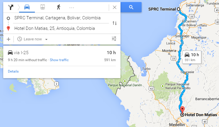
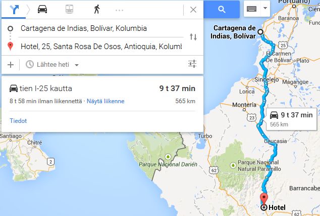
Google Navigation Challenge 2. Prudhoe Bay - Ushuaia

Archive for the three above subforums
User avatar
Shadaza
Posts: 2768
Joined: 05 Jun 2009, 23:49

Re: Google Navigation Challenge 2. Prudhoe Bay - Ushuaia

Post by Shadaza »

This wrote:
Simtek wrote:Now that everyone is converging on Colón and the North American portion of the race is approaching its conclusion I'd like to report a slight problem regarding Colombia: There doesn't seem to be any way of making routes that cross into neighbouring countries, meaning we would all be stuck in JPM's home country. This was of course a problem in the Edinburgh-Beijing challenge when people weren't able to make routes that crossed the Chinese border, a problem which was solved by having people camp at the border. I think a similar approach should be implemented here, with Shadaza's blessing of course.

In the original challenge, that was solved by posting two maps for 1 leg.


This is right, in the first challenge and what will carry on into this one, is you drive up to the border, take a picture with time stamp, and then with the time you have left carry on from the other side of the border.

Image

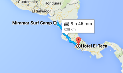
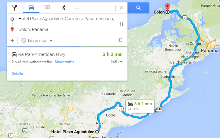
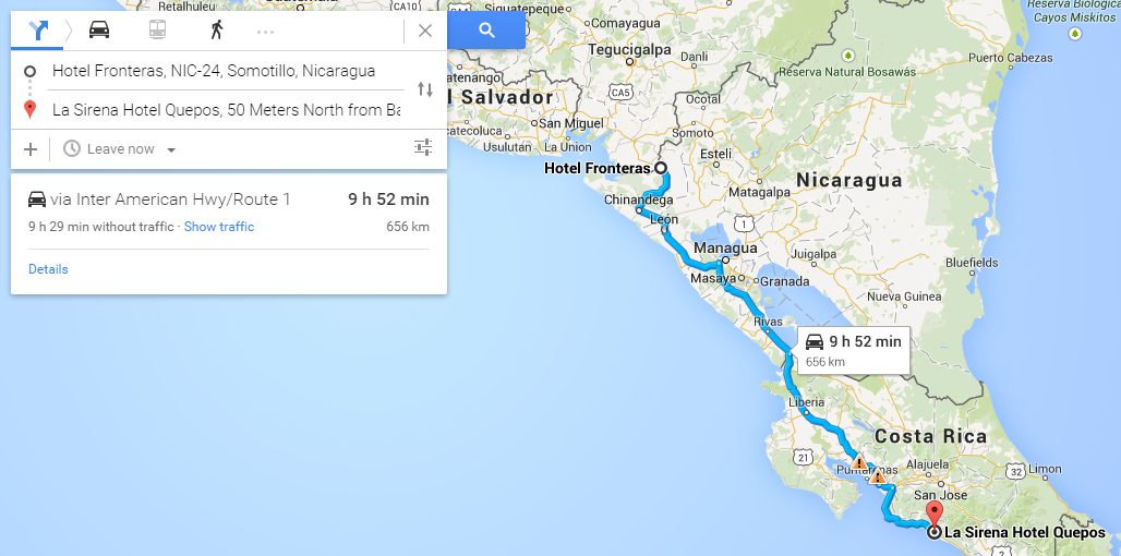
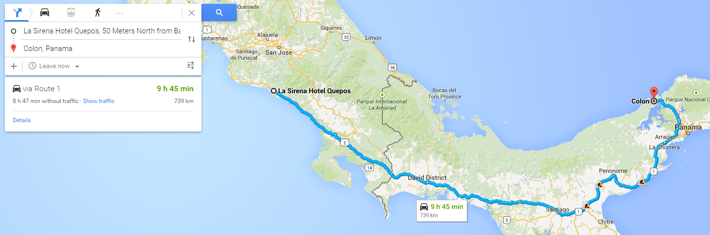
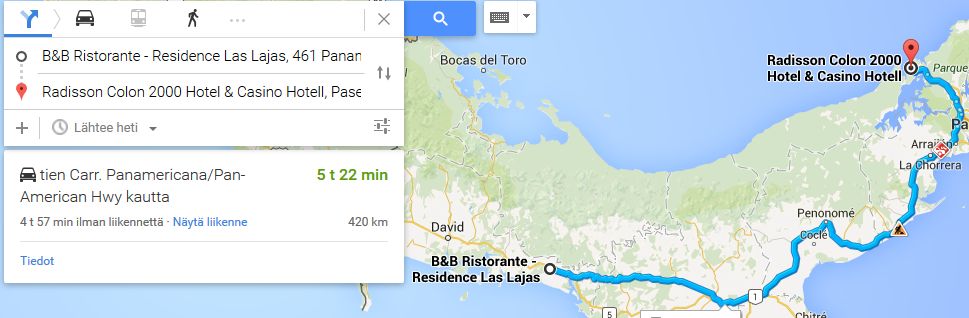
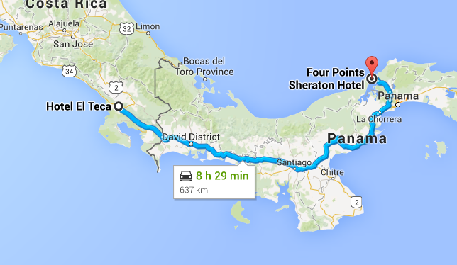
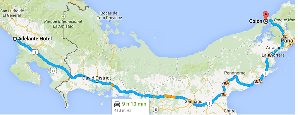
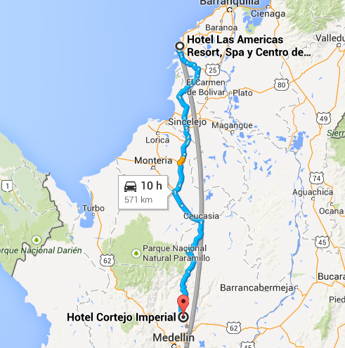
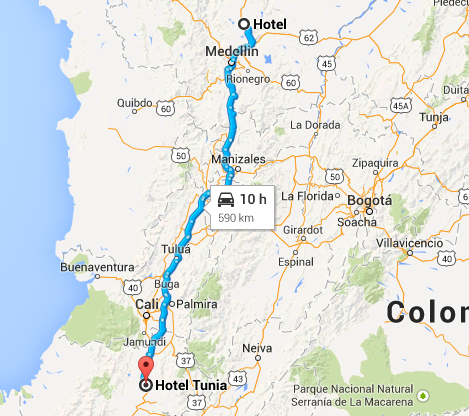
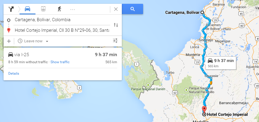
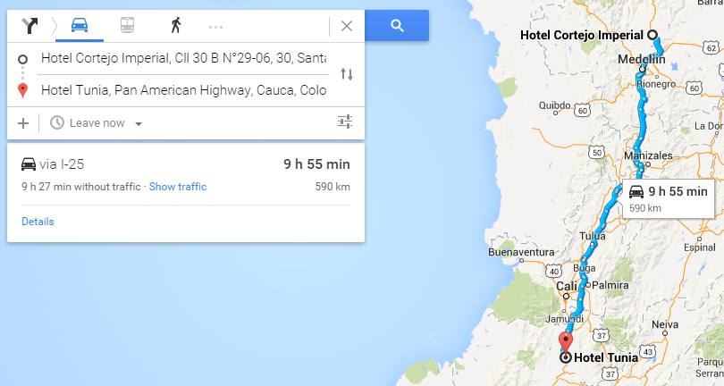
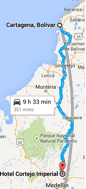
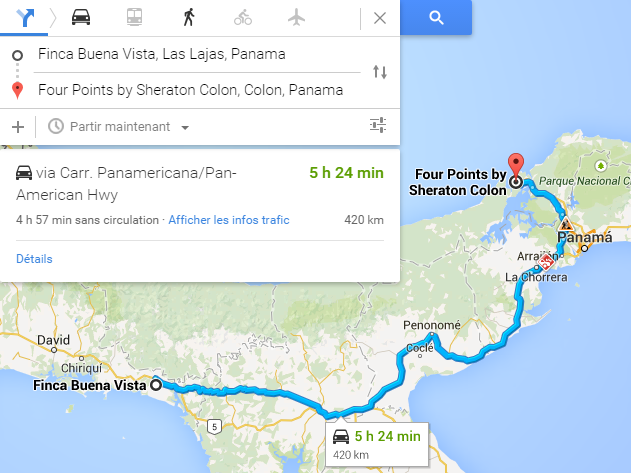
Leg 14. The 2 week mark. A minor niggle, as traffic meant we didn't get quite as far as hoped, but a big positive in the fact that I hear no teams have yet made it to Colon, so leg 15 looks set to be a big boat party with all the teams that will make it, myself included.
Message me on Discord.
User avatar
tommykl
Posts: 7072
Joined: 07 Apr 2010, 17:10
Location: Banbury, Oxfordshire, UK

Re: Google Navigation Challenge 2. Prudhoe Bay - Ushuaia

Post by tommykl »

Thomas De Bock wrote:Prudhoe Bay - Ushuaia Challenge - day 14: La Cruz to

One thing we weren't expecting in Costa Rica was company. We knew Lake Nicaragua would be a bottleneck, but we anticipated something more sperad out. Oh well. At least Nikolai and Nathan were good company. We quickyl learned that we planned on staying in the same town on the final night before reaching Colon. Perhaps we'd head for the same hotel. We each had ours picked, but didn't say, for added surprise.

This morning, we left the hotel in single file and headed down the highway, South East. Both us and them wanted to go a lot further than we would, but traffic, we'd heard, was notoriously bad in Costa Rica and Panama. And it was soon clear that this was mostly due to bad roads. We passed some small towns, including one called Puntarenas, which reminded us of our collective goal, that was still so far away...

Instead of turning towards the capital, San José, we stuck to the Pacific coastline, avoiding as much traffic as possible. This made for an absolutely stunning, but uneventful drive. After a while, the road turned away from the water, leaving us surrounded by jungle. Soon enough, we reached Panama. Putting the appropriate Van Halen song on the radio, we crossed customs without much issue and headed towards the city of David, which we referred to as Dave, Panama, before the state capital and namesake, Chiriqui. After that, our destination was straight ahead.

We soon turned off highway 1 into the small town of Las Lajas, and while the Nurms stopped at the very first hotel in sight, a quaint B&B, we weren't bothered by this. We knew we'd reach Colon the next day, so we moved further along to the Finca Buena Vista hotel. some peace and quiet before the hustle and bustle of the ferry to Colombia.


http://www.formularejects.com/uploader/ ... /leg14.png

Staying at Finca Buena Vista, Las Lajas, Panama.

Route details: Carrera Interamericana, La Cruz - Las Lajas.

5 days 15 hours 22 minutes total driving time
11628 kilometres total distance
kevinbotz wrote:Cantonese is a completely nonsensical f*cking alien language masquerading as some grossly bastardised form of Chinese

Gonzo wrote:Wasn't there some sort of communisim in the East part of Germany?
User avatar
Samster
Posts: 1658
Joined: 02 Feb 2010, 20:27
Location: Newark, England
Contact:

Re: Google Navigation Challenge 2. Prudhoe Bay - Ushuaia

Post by Samster »

Simtek wrote:Now that everyone is converging on Colón and the North American portion of the race is approaching its conclusion I'd like to report a slight problem regarding Colombia: There doesn't seem to be any way of making routes that cross into neighbouring countries, meaning we would all be stuck in JPM's home country. This was of course a problem in the Edinburgh-Beijing challenge when people weren't able to make routes that crossed the Chinese border, a problem which was solved by having people camp at the border. I think a similar approach should be implemented here, with Shadaza's blessing of course.


When planning my overall route through South America I also encounted the same issue for getting onto Tierra del Fuego as it seems Google doesn't have a ferry route there in its database though I'm sure there must be one in existence.
User avatar
DemocalypseNow
Posts: 13185
Joined: 17 Aug 2009, 09:30
Location: Lost, send help
Contact:

Re: Google Navigation Challenge 2. Prudhoe Bay - Ushuaia

Post by DemocalypseNow »

Jeremy-Etienne Voeckler wrote:We were pretty sure we had the lead for a few days now, but today was the confirmation. We left early enough to avoid any accidents on the 4 as had been the case most days previously on that particular stretch of road. After roadworks about an hour in, we were home free. It was a relaxing jaunt down the highway to Colon, just three hours!

We rocked up at the check-in point for the end of the "Apertura", if you will, and we were the only ones there. Literally. Bloke with the clipboard didn't show up for another hour after we arrived. Clearly he wasn't expecting anyone to arrive so soon! But I was cool with that, I climbed up to the roof of the Trafic and had a few beers, admiring the view of the Caribbean Sea, while we waited for the official to show up.

Freddy was pretty ecstatic to be the first of all to reach Colon. He's hyper-competitive like that. I'm just happy I get an extra 7 hours of rest! The boat is already at the terminal for most of the day before setting sail at 7pm, so I think I might go onboard early and check out the wine selection!

Now, where is everyone else....?

Image


Team Voeckler's Leg 15
Start: Hotel Plaza Aguadulce, Carretera Panamericana, Aguadulce 507, Panama
Finish: Colon, Panama
Image
Novitopoli wrote:Everytime someone orders at Pizza Hut, an Italian dies.
Novitopoli wrote:Juve's Triplete: Calciopoli, doping & Mafia connections.

Image Image
User avatar
Bobby Doorknobs
Posts: 4059
Joined: 30 Jul 2014, 17:52
Location: In a safe place.

Re: Google Navigation Challenge 2. Prudhoe Bay - Ushuaia

Post by Bobby Doorknobs »

Day 15
Start: Hotel El Teca, 25mts Oeste de la Cruz Roja, Palmar Norte, Puntarenas 60502, Costa Rica
Finish: Colon, Panama
Distance Traveled: 637 km
Time Traveled: 8h 38m
Total Distance: 11881 km
Total Time: 5d 21h 18m

Anthony Byrne wrote:And that's one continent out of the way as far as I'm concerned. It was plain sailing across yet another border and on to the other coast of Central America, the Caribbean one, which, like the Pacific one, is quite blue, and warm. It's pretty warm round these parts. I'm not the biggest fan of hot weather, but I can deal with it most of the time. A bit of tan never did me any harm. Except when it burnt. That can be slightly irritating at times. There wasn't much redness for either of us this time round though.

So we arrived in Colón a little wiser, having been through such extremes as frozen tundra and hot desert. Not to mention the long hours spent alone together on the road. We learned... very little about each other actually. Eoin's stoned most of the time anyway. We weren't sure if there was much rainforest coming up yet, having not decided what route we were going to take through South America, but no matter route we were taking it was going to be one long-ass trip, as if wasn't already. Anyway, we're just boarding the ferry now. I just hope we're not a day behind anyone else.
#FreeGonzo
User avatar
Samster
Posts: 1658
Joined: 02 Feb 2010, 20:27
Location: Newark, England
Contact:

Re: Google Navigation Challenge 2. Prudhoe Bay - Ushuaia

Post by Samster »

Leg 15 Quepos, Costa Rica - Colon, Panama https://www.google.co.uk/maps/dir/La+Si ... !3e0?hl=en

Smooth sailing through Panama as we make the Colon ferry with just 11 minutes to spare and it looks like everyone bar Peteroli will probably make it on the same one. Looks like the race will be reset tomorrow from Colombia.
User avatar
the Masked Lapwing
Posts: 4204
Joined: 10 Sep 2010, 09:38
Location: Oran Park Raceway

Re: Google Navigation Challenge 2. Prudhoe Bay - Ushuaia

Post by the Masked Lapwing »

Leg 14
Start: Hotel Fronteras, NIC-24, Somotillo, Nicaragua
Finish: La Sirena Hotel Quepos, 50 Meters North from Banco Nacional, Quepos 0, Costa Rica
Distance: 656 km
Time: 9 hrs, 52 mins

Image

Leg 15
Start: La Sirena Hotel Quepos, 50 Meters North from Banco Nacional, Quepos 0, Costa Rica
Finish: Colon, Panama
Distance: 739km (total 12,145 km)
Time: 9 hrs, 45 mins (total 5 days, 23 hours, 22 mins)

Image

Made it!
R.I.P.
GM HOLDEN
1948-2017
User avatar
DemocalypseNow
Posts: 13185
Joined: 17 Aug 2009, 09:30
Location: Lost, send help
Contact:

Re: Google Navigation Challenge 2. Prudhoe Bay - Ushuaia

Post by DemocalypseNow »

Also, there is a problem right at the end, because of the Punta Delgada crossing towards Ushuaia. Google Maps doesn't understand how to cross the river. So you reach the lighthouse and get stuck. There's only 6 hours between that crossing and the finishing point. So if two people arrive at the lighthouse on the same day, we're stuck with a tiebreaker.

I'm starting to think perhaps we did this challenge in the wrong direction. There are lots of limitations in South America that bunch the pack up again after anyone has barely had a chance to branch out. That, and there's quite a lack of options of routes to take. The only real question mark remaining is which route the teams take through Argentina.

Anyway, I can't do anything about the Ushisha problem, but a solution to a different problem; the ferry from Colon terminates in Punto Fijo, Venezuela instead of Cartagena, Colombia. This could shake up the race a bit by giving people the option to either head East or West on arrival.
Novitopoli wrote:Everytime someone orders at Pizza Hut, an Italian dies.
Novitopoli wrote:Juve's Triplete: Calciopoli, doping & Mafia connections.

Image Image
User avatar
Nessafox
Site Donor
Site Donor
Posts: 6226
Joined: 30 Nov 2009, 19:45
Location: Stupid, sexy Flanders.

Re: Google Navigation Challenge 2. Prudhoe Bay - Ushuaia

Post by Nessafox »

Biscione wrote:Also, there is a problem right at the end, because of the Punta Delgada crossing towards Ushuaia. Google Maps doesn't understand how to cross the river. So you reach the lighthouse and get stuck. There's only 6 hours between that crossing and the finishing point. So if two people arrive at the lighthouse on the same day, we're stuck with a tiebreaker.

I already figured tiebreakers were going to be important. But as of yet, Shadaza hasn't told us yet what the tiebreaker will be...
Also, i did my research, and the ship going from colon to cartagena is not a ferryIt's a uncomfortable cold huge containership transporting travellers and their cars. The trip is between 25 and 30 days, including lots of complicated administration work. (the actual trip is just a few days though)
Obviously it doesn't matter for the race, but it will hava significant impact on the storylines once we reach Colombia!
I don't know what i want and i want it now!
User avatar
Bobby Doorknobs
Posts: 4059
Joined: 30 Jul 2014, 17:52
Location: In a safe place.

Re: Google Navigation Challenge 2. Prudhoe Bay - Ushuaia

Post by Bobby Doorknobs »

This wrote:
Biscione wrote:Also, there is a problem right at the end, because of the Punta Delgada crossing towards Ushuaia. Google Maps doesn't understand how to cross the river. So you reach the lighthouse and get stuck. There's only 6 hours between that crossing and the finishing point. So if two people arrive at the lighthouse on the same day, we're stuck with a tiebreaker.

I already figured tiebreakers were going to be important. But as of yet, Shadaza hasn't told us yet what the tiebreaker will be...
Also, i did my research, and the ship going from colon to cartagena is not a ferryIt's a uncomfortable cold huge containership transporting travellers and their cars. The trip is between 25 and 30 days, including lots of complicated administration work. (the actual trip is just a few days though)
Obviously it doesn't matter for the race, but it will hava significant impact on the storylines once we reach Colombia!

But Shadaza said it was a magic ferry that transports us instantly to Colombia...
#FreeGonzo
User avatar
Nessafox
Site Donor
Site Donor
Posts: 6226
Joined: 30 Nov 2009, 19:45
Location: Stupid, sexy Flanders.

Re: Google Navigation Challenge 2. Prudhoe Bay - Ushuaia

Post by Nessafox »

Leg 15:

!Si señor!
The spanish is really getting to my head. We realised we slept in a Spain-themed hotel this night too. Alone, nice rest, but we might be the last ones to make it today. If we even make it today.
The route wasn't much different, as we expected. But Costa Rica is very touristic. If we'd ever go on a holiday in Latin America, it will probably be here. All rainforesty here. I'm surprised that after all that mosquito bite, i still got blood left. Thankfully we didn't pick up any other tropical animals
[hears sissing noise]
waaaaaaaaaaaaaah waaaaaaaaaaaaah waaaaaaaaaaaaah a snake! Aaaaaaaaaaaaaaaaaaaaaah aaaaaaaaaaaaaaaaaaaaaaah aaaaaaaaaaaaaaaaaaaaah snake! Kill it! Kill it! Kill it! Kill it! Kill it!
Oh, it was just my inflatable crocodile deflating. Phew. I might ask some of the other teams to fix it, but i'm afraid they aren't going to give it back. They should have brought their own beach stuff, damn it! After the rainforest we reached Jerusalem. What? Can't they pick any original names? At least Deadhorse sounded original!
This however meant we reached Panama. The last country of the northern continent! The first major city we passed was David. Apperently the Panamese like jewish things? It's a good thing there are no German teams competing, i guess... Anyway after a long, long drive, with sometimes slow traffic, we reached the outskirts of Panama city. We weren't heading that way though. The Darien Gap has the reputation that either people get shot by Panamese or Colombian military, or get eaten by local tribes. So we headed to Colon, direction Carribean Sea. We saw the mighty mighty Panama Canal. We saw more rainforest, another big lake. And there it was, Colon!
Some local guy we met at a bank (as we needed some money to pay for the boat) said he met lot of people in a 'race' and asked if we were part of it. He also asked why they were headed into a mountainous suburb, saying that the Container terminal was totally the other way. He had a good point there. Either we, as the boat isn't leaving until the morning, we picked a nice luxerious hotel.
The boat trip is going to be long, so we have lot of time to think about the route we're going to take in South-America. It's like America, but south! The land of Maldonado or the land of Maldonadon't? That's the question!


Start: Costa Brava, Quepos, Costa Rica
Finish: Four Points Sheraton Hotel, Colon, Panama (because am i the only one going to sleep before the ferry/container ship leaves in the morning and the other people are sleeping in the mountains beneath a starry sky?)
Distance Traveled: 743 km
Time Traveled : 9h 53m
Total Distance: 11990 km
Total Time: 6d 0h 15m

Image

Simtek wrote:But Shadaza said it was a magic ferry that transports us instantly to Colombia...

I am strongly against the idea of allowing magic. Maybe that's for the next navigation challenge, when we all head on a quest to Camelot!
I don't know what i want and i want it now!
User avatar
WaffleCat
Posts: 2293
Joined: 08 Jan 2012, 13:02
Location: Singapore

Re: Google Navigation Challenge 2. Prudhoe Bay - Ushuaia

Post by WaffleCat »

LEG 15

Start: Hotel Vista al cerro, Barrio Los Ángeles, Palmar Norte, Costa Rica
End: Four Points Sheraton, Colon, Panama
Leg Time: 8 hr, 29 mins
TOTAL TIME: 5 days, 21 hours, 53 minutes

Hotel Vista al Cerro

Mike stayed up all night. After his uncurling bug experience yesterday, he noticed a similar creature next to his pillow. He stayed up for as long as it was in the room. Which was the entire night.

The moment we reached the comfort of our car, Mike fell asleep.

He would not wake up again until Colon. Yippee.

Colon

With Mike passed out in the passenger's seat, we arrived at Colon on our last, uninteresting leg of the trip. As we boarded the ferry, met the Belgians who we were travelling with for the early part of this trip, the French brothers who we didn't even notice at Deadhorse, and the stoned Irish. I greeted them like an adventurer would, a smile and a handshake, all ready to talk about how we're going to tackle South America.

Behind me was Mike, half awake after the long sleep in the car, stumbling around and walking right off the gangway into the harbour. He was rescued by fishermen on a nearby boat, grabbing him with the net used for their latest catch.

Well done Mike. Perfect summary of your contribution to this race so far.
My friend's USB drive spoiled, spilled tea on her laptop and had a bird poo in her hand.

What did she do in her past life to deserve this?

Signup for the Random Racing League, Season TWO!!!
User avatar
Nuppiz
Site Donor
Site Donor
Posts: 5935
Joined: 30 Mar 2009, 12:10
Location: Vantaa, Finland
Contact:

Re: Google Navigation Challenge 2. Prudhoe Bay - Ushuaia

Post by Nuppiz »

Leg 15
Start: B&B Ristorante - Residence Las Lajas, 461 Panamá
Finish: Radisson Colon 2000 Hotel & Casino Hotell, Paseo Gorgas, Colón, Panama
Distance: 420 kilometres (261 miles)
Time: 5 hrs 22 mins

Total distance: 11692 kilometres (7265 miles)

Image

Nathan Nurmester wrote:Day 15. The place we stayed at should be renamed as B&"B", as that was one of the worst breakfasts I've had in years. In fact we were a bit delayed as I had to wait for a while for my stomach to settle. Either way we contined towards Colón, knowing that unless there's a major disaster or something we'll easily reach the city. And despite being slowed down by an accident outside of Panamá (what an imaginative name for a capital city) we reached Colón with almost half of our daily driving allowance still left. We met some of the other teams, some who had settled in the hotel nearest to the docks and some where just cruising around and enjoying the city. As it was still early we spent some time searching for a suitable hotel, and found one that has a casino as well. Maybe we can increase our travel budget for the South American leg here.
Eurosport broadcast for the 1990 Mexican GP prequalifying:
"The Life, it looked very lifeless yet again... in fact Bruno did one, slow lap"
User avatar
Peteroli34
Posts: 1957
Joined: 25 May 2013, 10:01
Location: Thurrock, Which isn't London

Re: Google Navigation Challenge 2. Prudhoe Bay - Ushuaia

Post by Peteroli34 »

Day 15

Start: Hotel Cristiano, Pan-American Highway, Esteli, Nicaragua
Finish:Adelante Hotel, Ojochal, Puntarenas, Costa Rica
Distance Traveled: 411 Miles
Time Traveled: 9H 43M
Total Distance:7484 Miles
Total Time: 5 Days 23 Hours 40 Minutes

Image

We awake on Day 15 and it seems that Panama and Costa Rica didn't go to war. The ferry hasn't sunk at its berth. So i guess we are resigned to the fact that we are going to be a whole day behind the team in front of us. Begin to wonder while we are bothering we are not quitters unlike some of the other teams we started so we shall finish
User avatar
tommykl
Posts: 7072
Joined: 07 Apr 2010, 17:10
Location: Banbury, Oxfordshire, UK

Re: Google Navigation Challenge 2. Prudhoe Bay - Ushuaia

Post by tommykl »

Thomas De Bock wrote:Prudhoe Bay - Ushuaia Challenge - day 15: Las Lajas to Colon

Really not that much to say about the hotel. The main event was confirmation that the Voecklers hadn't reached Colon yet, and that we would all board the same ferry. The Nurmies would probably reach Colon a couple minutes before us. We were planning on staying in a hotel by the docks.

This leg wasn't extremely interesting, as we were pacing ourselves to get to Colon in time. We passed some anonymous towns and cities, a road accident on the outskirts of Panama City, then crossing the major highlight of the leg. Y'all had the map in hand, and there it was. A man. A plan. A canal...Panama!

After going 'round Panama City, we turned North and quickly reached Colon. We stopped at the well-marked Four Points Sheraton, one of the few clean spots in the city, which seems to have really let itself go. We stopped our car out of view of everyone else and got up to our room. A few hours later, we got down to the lobby and met the Flemish ladies we hadn't seen since Deadhorse as well as the notorious Mike. We were told other teams were still driving around and enjoying the sights, with the Nurmies in another hotel. We had the whole day tomorrow to enjoy the scenery. Only one team was still going that would reach Colon tomorrow.


http://www.formularejects.com/uploader/ ... /leg15.png

Staying at the Four Points by Sheraton Colon, Colon, Panama

Route details: Las Lajas - Colon.

5 days 20 hours 46 minutes total driving time
12048 kilometres total distance
kevinbotz wrote:Cantonese is a completely nonsensical f*cking alien language masquerading as some grossly bastardised form of Chinese

Gonzo wrote:Wasn't there some sort of communisim in the East part of Germany?
User avatar
Shadaza
Posts: 2768
Joined: 05 Jun 2009, 23:49

Re: Google Navigation Challenge 2. Prudhoe Bay - Ushuaia

Post by Shadaza »

Image

We arrive to a festival like atmosphere, everybody, sorry, NEARLY everybody has made it on the same day so we can all celebrate an over night party on the ferry to Cartagena as everyone will head off together to start the final (but still impressively long!) stretch of the race.
Message me on Discord.
User avatar
Shadaza
Posts: 2768
Joined: 05 Jun 2009, 23:49

Re: Google Navigation Challenge 2. Prudhoe Bay - Ushuaia

Post by Shadaza »

https://www.google.com/maps/d/edit?mid= ... SVdx09E75w

The map for todays leg. It took hours of work to get the detail in this one.
Message me on Discord.
User avatar
Nessafox
Site Donor
Site Donor
Posts: 6226
Joined: 30 Nov 2009, 19:45
Location: Stupid, sexy Flanders.

Re: Google Navigation Challenge 2. Prudhoe Bay - Ushuaia

Post by Nessafox »

Well... someone's got to do it! (i suppose leg 16 is open)

A magical ferry is what the organisers promised. A party boat they said. Well, it turned out to be a rented small containership, but it's still a huge improvement over what we would do without their help. Thankfully all the paperwork was done in advance. But no matter, it turned out to be a big party on the ocean. 9 teams made it. From what we heared, only one other was still sightseeing in Costa Rica, and all the rest gave up. That's just lame. We waited for the right moment to take out a few bottles of tequila we bought in a souvenir shop in Panama. Tequila isn't Panamese at all, but who cares.
!Fiesta!
The boat was kind of slow, and when we were running out of alcohol and running out of sea chanties, Cartagena was finally in sight! (altough i'm sure those teams still have some alcohol hidden) We rested in Hotel Oceano, which was close to the Terminal Maritimo.
Ahoy, filthy landlubbers! This being the Carrrrrrrrrrrribean after all, mateys! This wench be entering the Americas of south!
Enough with the pirate stuff, serious work now. Columbia is one of those countries you'd rather avoid.
Initially the road looked to progress fast, as it was rather flat, compared to central America. The sights were rather agricultural, you could smell the coffee and cocaine! Not that i know how cocaine smells like...
No, mom, i never tried cocaine! Only marijana, xtc, speed and stuff like that, but never cocaine!
Well, that should do it! Parents! Right? In the end of the day the road got more mountainous though, and i think that's where we lost lots of time. We didn't make it to Medellin, but i got a feeling that in Colombia, it will be the safest thing to avoid the big cities. So yeah, we showed our colour, we are doing the Andes route. It was a close call, but i prefer the sea over the jungle.


Start: Hotel Oceano, Diagonal 21 # 45-35, Cartagena, Bolívar 214535, Colombia (closest to the container terminal)
Finish: Hotel Cortejo Imperial, Cll 30 B N°29-06, 30, Santa Rosa De Osos, Antioquia, Colombia
Distance Traveled: 563 km
Time Traveled : 9h 40m
Total Distance: 12553 km
Total Time: 6d 9h 55m

Image
I don't know what i want and i want it now!
User avatar
DemocalypseNow
Posts: 13185
Joined: 17 Aug 2009, 09:30
Location: Lost, send help
Contact:

Re: Google Navigation Challenge 2. Prudhoe Bay - Ushuaia

Post by DemocalypseNow »

Frederic-Maxime Voeckler wrote:I hate the roads here. So much traffic. We should have been able to make it almost to Medellin. It looked like we would have to settle in Santa Rosa de Osos, there were no hotels for almost another 30 minutes. But, a miracle - the truck driver at the head of the queue he was causing pulled over, and we did some questionable overtaking to jump cars head of us. It gained us a precious few minutes, allowing us to press on to the town of Don Matias.

I think there will be a lot of other teams shaking their fist at that truck driver for leaving them stuck behind us in Santa Rosa de Osos.

It's a little disheartening to have done such a good job in the first half of the race, winning the Apertura in such convincing fashion, and then having that lead almost entirely eradicated. Couldn't we have had a 3 hour headstart on the rest or something? :(


Start: SPRC (Maritime) Terminal, Cartagena, Colombia
Finish: Hotel Don Matias, 25, Antioquia, Colombia
Image
Novitopoli wrote:Everytime someone orders at Pizza Hut, an Italian dies.
Novitopoli wrote:Juve's Triplete: Calciopoli, doping & Mafia connections.

Image Image
User avatar
Peteroli34
Posts: 1957
Joined: 25 May 2013, 10:01
Location: Thurrock, Which isn't London

Re: Google Navigation Challenge 2. Prudhoe Bay - Ushuaia

Post by Peteroli34 »

Day 16

Start: Adelante Hotel, Ojochal, Puntarenas, Costa Rica
Finish: Colon Panama
Distance Traveled: 413 Miles
Time Traveled: 9H 10M
Total Distance:7897 Miles
Total Time: 6 Days 8 Hours 50 Minutes

Image

Our day 16 is spent travelling through the horrendous Panama traffic while all the other teams are somewhere in the Caribbean sea on their way towards Cartegna. We are a day behind them maybe we an make the time up in South America who knows.
User avatar
Samster
Posts: 1658
Joined: 02 Feb 2010, 20:27
Location: Newark, England
Contact:

Re: Google Navigation Challenge 2. Prudhoe Bay - Ushuaia

Post by Samster »

Leg 16 Cartagena - Santa Rosa de Osos https://www.google.co.uk/maps/place/Hot ... e7db?hl=en

Colombia sucks!!!! :facepalm:

Seriously what is with the lack of viable routes through here, the only decent through route to head south was to head down 25 and that will surely be where everyone is going to go. To make matters more annoying, Medellin was just out of reach as was the ideal hotel in Don Matias (only four minutes) so we had to back track half an hour to Santa Rosa to the imaginatively named 'Hotel'. At least this town had a reasonable selection of hotels but we went for this one as its on the main road. I predict we will be joined by just about every team.

On a side note it doesn't look like there will be much if any variance in route till around Lima.
User avatar
Nuppiz
Site Donor
Site Donor
Posts: 5935
Joined: 30 Mar 2009, 12:10
Location: Vantaa, Finland
Contact:

Re: Google Navigation Challenge 2. Prudhoe Bay - Ushuaia

Post by Nuppiz »

Leg 16
Start: Cartagena de Indias, Bolívar, Columbia
Finish: Hotel, 25, Santa Rosa De Osos, Antioquia, Columbia
Distance: 565 kilometres (351 miles)
Time: 9 hrs 37 mins

Total distance: 12257 kilometres (7616 miles)

Image
Eurosport broadcast for the 1990 Mexican GP prequalifying:
"The Life, it looked very lifeless yet again... in fact Bruno did one, slow lap"
User avatar
WaffleCat
Posts: 2293
Joined: 08 Jan 2012, 13:02
Location: Singapore

Re: Google Navigation Challenge 2. Prudhoe Bay - Ushuaia

Post by WaffleCat »

LEG 16

Start: Hotel Oceano, Diagonal 21, Cartagena, Colombia
End: Hotel La Circasia, Santa Rosa De Osos, Antioquia Department, Colombia
Leg Time: 9 hours, 35 minutes
TOTAL TIME: 6 days, 7 hours, 28 minutes

Cartagena

Mike smelt of fish all the way on the ferrCONTAINERSHIPWITHNOFREAKINWINDOWSOFCOURSEI'DKEEPTHEFISHSMELLWITHNOFREAKINVENTILATION

Sorry, Mike took my phone once again. Yeah, he stank all the way there. We checked into the Hotel Oceano for a record 10 minutes just to let Mike bathe at get rid of that awful smell. I let Mike take the wheel for a while, even though I doubted his ability to cross two continents when he can't even walk straight for five feet.

Well, he already crossed one. Let's see if we can cross another.

Taraza

We had a late lunch at the Cafeteria Alaska. Mike could not stop laughing at the name and the situation about it. He kept saying "WE WERE THERE!" and started laughing crazily. I stared at him, disapproving The waiter stared at him, puzzled. Patrons stared at him, disgusted.

Mike has an unusual sense of humour.

Manzanares

There were some wobbly mountain roads here. Given Mike's previous experiences, I got out a sick bag a stole from the container ship and had it at the ready for Mike.

Nope. Mike was squeeing. He was having fun. Every whump into a turn, Mike would get all hyper. He kept encouraging me to faster. He was having the time of his life. He even took over the wheel forcibly to drive this road for himself, nearly ending our trip in flames and a roadside memorial dedicated to an adventurer and an idiot. Mike was having so much fun.

This is not the Mike I know.

Santa Rosa De Osos

This is NOT the Mike I know.

It must be the coffee.

Mike is so high, he's speaking fluent Portuguese to the receptionist at our hotel

This is Colombia. They speak Spanish.

Mike is so high, he managed to convince me to stop at the hotel before our planned stop for the day with logical reasoning. He say's we're closer to the expressway, we can go faster and catch up in no time.

We should stay in Colombia.

Mike took over the keyboard then. I like him when he's drunk on coffee.
My friend's USB drive spoiled, spilled tea on her laptop and had a bird poo in her hand.

What did she do in her past life to deserve this?

Signup for the Random Racing League, Season TWO!!!
User avatar
Bobby Doorknobs
Posts: 4059
Joined: 30 Jul 2014, 17:52
Location: In a safe place.

Re: Google Navigation Challenge 2. Prudhoe Bay - Ushuaia

Post by Bobby Doorknobs »

Day 16
Start: Cartagena, Bolívar, Colombia
Finish: Hotel, 25, Santa Rosa De Osos, Antioquia, Colombia
Distance Traveled: 565 km
Time Traveled: 9h 35m
Total Distance: 12446 km
Total Time: 6d 6h 53m

Anthony Byrne wrote:Good news. We caught up with the race leaders, as did almost everyone else, with a few exceptions. All but one of those exceptions had actually pulled out of the race. The one that was still in this was at large somewhere in Costa Rica. Eoin spent the night socialising and doing God knows what with everyone else on board the ferry. I mostly kept to myself, planning the next leg of the trip, deciding on whether to go by the Andes or the Amazon. By the time we made to Cartagena I had made up my mind: We were heading south immediately. We set off in the Beetle towards Medellin. The Ecuadorian border was our target for the next couple of days. Medellin proved too far to make in one day, so we stopped in a hotel by the side of the highway. It seemed we weren't the only ones there.
#FreeGonzo
User avatar
Shadaza
Posts: 2768
Joined: 05 Jun 2009, 23:49

Re: Google Navigation Challenge 2. Prudhoe Bay - Ushuaia

Post by Shadaza »

Image


End location, Hotel Cortejo Imperial
Message me on Discord.
User avatar
Shadaza
Posts: 2768
Joined: 05 Jun 2009, 23:49

Re: Google Navigation Challenge 2. Prudhoe Bay - Ushuaia

Post by Shadaza »

No map today, but all teams are now in Colombia (Peteroli just arriving on da boat). All teams are making there way south towards Ecuador. Nobody deciding to travel Guyana, Brazil way :P.

The next leg is officially open. I apologise for the naffness of this post.
Message me on Discord.
User avatar
Bobby Doorknobs
Posts: 4059
Joined: 30 Jul 2014, 17:52
Location: In a safe place.

Re: Google Navigation Challenge 2. Prudhoe Bay - Ushuaia

Post by Bobby Doorknobs »

#FreeGonzo
User avatar
Nessafox
Site Donor
Site Donor
Posts: 6226
Joined: 30 Nov 2009, 19:45
Location: Stupid, sexy Flanders.

Re: Google Navigation Challenge 2. Prudhoe Bay - Ushuaia

Post by Nessafox »

Well, if Peteroli doesn't take the Brazil route, we're not going to see much variation until reaching Argentina.
I don't know what i want and i want it now!
User avatar
DemocalypseNow
Posts: 13185
Joined: 17 Aug 2009, 09:30
Location: Lost, send help
Contact:

Re: Google Navigation Challenge 2. Prudhoe Bay - Ushuaia

Post by DemocalypseNow »

Down to only 8 participants in Leg 16. Numbers dwindling fast.
Novitopoli wrote:Everytime someone orders at Pizza Hut, an Italian dies.
Novitopoli wrote:Juve's Triplete: Calciopoli, doping & Mafia connections.

Image Image
User avatar
Bobby Doorknobs
Posts: 4059
Joined: 30 Jul 2014, 17:52
Location: In a safe place.

Re: Google Navigation Challenge 2. Prudhoe Bay - Ushuaia

Post by Bobby Doorknobs »

Going to start posting screenshots from now on because the link isn't always sufficient proof ;)

Leg 17
Start: Hotel, 25, Santa Rosa De Osos, Antioquia, Colombia
Finish: Hotel Tunia, Pan American Highway, Cauca, Colombia
Distance Traveled: 590 km
Time Traveled: 10h :glasses:
Total Distance: 13036 km
Total Time: 6d 16h 53m


Anthony Byrne wrote:Colombia, day 2. We shared a hotel with a couple of other teams. Most of us actually stopped in the same town, but the Voecklers, who I definitely do not remember seeing in Prudhoe carried on. This wasn't another Grande Prairie, was it? We pressed on regardless through Medellin and around Cali before stopping at the Hotel Tunia, our last stop before Ecuador, most likely. We were lucky to make it just seconds before the clock ran out.

Image
#FreeGonzo
User avatar
Nessafox
Site Donor
Site Donor
Posts: 6226
Joined: 30 Nov 2009, 19:45
Location: Stupid, sexy Flanders.

Re: Google Navigation Challenge 2. Prudhoe Bay - Ushuaia

Post by Nessafox »

Leg 17!

Story time! The day started with mountainsy roads. I got dizzy. We drove together with many other teams, it reminded us of Alaska. Well, except that here in Colombia it's ridiculously hot.. We lost sight of the french guys again, altough we could still see their trail of croissant crumbles. After a little bit mountains, as we already mentioned, we reached Bello. Contrary to the name, this wasn't such a beautiful city at all. Then the metropole of Medellin. As expected, the traffic was a little bit slower here. After the relatively flat city, another mountain range. For some inexplicable reason there was a traffic jam near the town of Montenegro. Well, i guess we haven't seen a slavic name yet... We had the option of going right to Sevilla (they're obsessed with Europe!) But we didn't, instead we drove trough... Palestina. Oh god. When we were close to Armenia again, we really lost our patience. The Colombians are defenitely the worst in naming cities! Armenias everywhere! We almost get lost near La Virginia. That was a joke. Laugh at my jokes! And now that we're at it, we also passed Andalucia. Reminds me of Andalouse sauce. I miss frites! I miss Belgium!
Our first target was making sure we at least reached Cali. We made that comfortably. We hoped to reach Popayan, but when we were near El Palmar, we decided to stop at a hotel. First we saw a lousy motel called 'Puerto Amor'. We could use some extra money, but i wouldn't ever go that low. Altough i have a suspicion some of the guys will stop there for the night... Thankfully a little further, we found a hotel, which was also a restaurant. We saw some people drive a little off-road into another hotel. I think it's the Irish team. Tomorrow we'll be finally out of this scary country.


Start: Hotel Cortejo Imperial, Cll 30 B N°29-06, 30, Santa Rosa De Osos, Antioquia, Colombia
Finish: Restaurante Hotel la Rana, Colombia
Distance Traveled: 590 km
Time Traveled : 9h 52 m
Total Distance: 13143 km
Total Time: 6d 19h 47m

Image
I don't know what i want and i want it now!
User avatar
the Masked Lapwing
Posts: 4204
Joined: 10 Sep 2010, 09:38
Location: Oran Park Raceway

Re: Google Navigation Challenge 2. Prudhoe Bay - Ushuaia

Post by the Masked Lapwing »

Leg 16
Start: Cartagena, Colombia
Finish: Hotel Cortejo Imperial, Cll 30 B N°29-06, 30, Santa Rosa De Osos, Antioquia, Colombia
Distance: 565 km
Time: 9 hrs, 37 mins

Image

Leg 17
Start: Hotel Cortejo Imperial, Cll 30 B N°29-06, 30, Santa Rosa De Osos, Antioquia, Colombia
Finish: Hotel Tunia, Pan American Highway, Cauca, Colombia
Distance: 590 km (total 13,200 km)
Time: 9 hrs, 55 mins (total 6 days, 18 hrs, 54 mins)

Image
R.I.P.
GM HOLDEN
1948-2017
User avatar
tommykl
Posts: 7072
Joined: 07 Apr 2010, 17:10
Location: Banbury, Oxfordshire, UK

Re: Google Navigation Challenge 2. Prudhoe Bay - Ushuaia

Post by tommykl »

Apologies for not being able to post my leg yesterday. I'll catch up when I get back from uni a few hours from now.
kevinbotz wrote:Cantonese is a completely nonsensical f*cking alien language masquerading as some grossly bastardised form of Chinese

Gonzo wrote:Wasn't there some sort of communisim in the East part of Germany?
User avatar
tommykl
Posts: 7072
Joined: 07 Apr 2010, 17:10
Location: Banbury, Oxfordshire, UK

Re: Google Navigation Challenge 2. Prudhoe Bay - Ushuaia

Post by tommykl »

Thomas De Bock wrote:Prudhoe Bay - Ushuaia Challenge - day 16: Cartagena to Don Matias

The party boat was in much less of a party mood when we realised it was a glorified container ship taking us to Cartagena. We were anticipating the Voecklers to be our main competition, and having slept on the boat just before arrival, we began leg 16 straight from the docks. There were two general routes through South America. We could stay close to the Pacific and go through Ecuador and Peru, or we could head East through Venezuela and hope for easier roads and more hotels in Brazil and Argentina. As it turned out, all of us went the first way.

We left Cartagena and headed South on highway 90. Driving straight through the jungles/marshlands of Colombia and avoiding the notorious cartels (although we weren't quite sure what to do to avoid them, we were content with not actively seeking them out), we passed through Sincelejo. We were on our way to Medellin. Heading South, we were getting progressively far from the Pacific. We weren't expecting much loneliness for the first few days, as the state of the roads and sparseness of the population made for little choice in accommodation. It was worse than Central America!

Thanks to our early start, we weren't too blocked up by traffic, but knew we wouldn't quite reach Medellin, so we stopped in the small town of Don Matias after 9 hours and 43 minutes. A while later, the Voecklers (who hadn't left the docks when we started) got there as well. some familiar company...


http://www.formularejects.com/uploader/ ... /leg16.png

Staying at the Hotel Don Matias, 25, Don Matías, Antioquia, Colombia

Route details: SPRC Docks, Cartagena - 25, Don Matias.

6 days 6 hours 29 minutes total driving time
12639 kilometres total distance

Thomas De Bock wrote:Prudhoe Bay - Ushuaia Challenge - day 17: Don Matias to Popayan

So far, the Colombian traffic had been light enough, something we were very surprised about. Today, we went through Medellin, again leaving a bit before the Voecklers, hoping to gain a bit of ground through traffic. It seemed that Medellin was on its best behaviour. No traffic, and we only barely heard the sound of gunfire in the distance. We only felt moderately threatened rather than heavily threatened, which was something of a plus.

We continued due South on highway 25 past the Medellin suburbs towards Manizales, Pereira and Cali. The roads weren't much better than in the North of the country, but we still made good time on the way. We knew most teams had stopped about 15 minutes up the road on day 16, and we were confident they wouldn't reach our end destination, instead stopping around Tunia. We were able to keep going for another 40 minutes or so, taking a pleasant potential lead and arriving in Popayan with a couple minutes to spare. We had a good choice of hotels and stopped at the quaint Hotel Los Andes. We're not really in a place I'd comfortably call the Andes yet, but I'll let it slide. You know, marketing and all...


http://www.formularejects.com/uploader/ ... /leg17.png

Staying at the Hotel Los Andes, Pan American Hwy, Popayán, Cauca, Colombia

Route details: 25, Don Matias - Pan American Hwy, Popayán.

6 days 16 hours 29 minutes total driving time
13238 kilometres total distance
kevinbotz wrote:Cantonese is a completely nonsensical f*cking alien language masquerading as some grossly bastardised form of Chinese

Gonzo wrote:Wasn't there some sort of communisim in the East part of Germany?
User avatar
Peteroli34
Posts: 1957
Joined: 25 May 2013, 10:01
Location: Thurrock, Which isn't London

Re: Google Navigation Challenge 2. Prudhoe Bay - Ushuaia

Post by Peteroli34 »

Day 17

Start: Cartagena Colombia
Finish: Hotel Cortejo Imperial, Santa Rosa de Osos - Antioquia Department, Colombia
Distance Traveled: 351 Miles
Time Traveled: 9H 33M
Total Distance:8248 Miles
Total Time: 6 Days 18 Hours 23 Minutes

Image

A day after all the other remaining teams arrived in Colombia we disembarked form our ferry which for some reason looked exactly like a dilapidated container ship, but hey I am no expert in ships it got us here somehow. We of course head south trying to catch the rest of the pack. After over 9 and half hours of driving we are astonished to have only covered 351 miles. an average 36 MPH I could have walked quicker then that. We pull into a hotel the man at the desk wonders why we were later then the other teams that had stayed last night. I told him where to go. At least I think I did I cant speak Spanish
User avatar
Nuppiz
Site Donor
Site Donor
Posts: 5935
Joined: 30 Mar 2009, 12:10
Location: Vantaa, Finland
Contact:

Re: Google Navigation Challenge 2. Prudhoe Bay - Ushuaia

Post by Nuppiz »

Leg 17
Start: Hotel, 25, Santa Rosa De Osos, Antioquia, Columbia
Finish: Hotel, 31, Miranda, Cauca, Columbia
Distance: 519 kilometres (323 miles)
Time: 9 hrs 23 mins

Total distance: 12776 kilometres (7939 miles)

Image
Eurosport broadcast for the 1990 Mexican GP prequalifying:
"The Life, it looked very lifeless yet again... in fact Bruno did one, slow lap"
User avatar
Shadaza
Posts: 2768
Joined: 05 Jun 2009, 23:49

Re: Google Navigation Challenge 2. Prudhoe Bay - Ushuaia

Post by Shadaza »

Image

Here to here!

Colombia is an interesting country, possibly the most of all so far, however in terms of viable route choices, not many. I actually am liking this phase of the race. But unfortunately won't be doing a map summary today, likely not doing one tomorrow either.

Feel free to post you next leg from 2-3 hours from now.
Message me on Discord.
User avatar
Samster
Posts: 1658
Joined: 02 Feb 2010, 20:27
Location: Newark, England
Contact:

Re: Google Navigation Challenge 2. Prudhoe Bay - Ushuaia

Post by Samster »

Leg 17 Santa Rosa de Osos - Santander de Quilichao https://www.google.co.uk/maps/dir/Hotel ... !3e0?hl=en

Well Medellin was a pain, worst city we have been through for traffic so far. With the city's reputation as a crime hotshot we weren't sure we would make it through with all of the wheels still on the car. But eventually we were on our way further south playing some more of follow the leader. Eventually we made it to Cali which thankfully had what Medellin lacked, an actual bypass! We made it just past Cali before calling it a day in the town of Santander de Quilichao. Seems some of the teams that were able to leave earlier in the day and avoid the worst of the Medellin traffic have managed to make it a little further on however. Hopefully we can be in Ecuador tomorrow and out of this cocaine smoking hellhole! (Apologies if anyone reading is from Colombia).

And to those that thought going east of the Andes would have been an option, you'd have to be mad, the nearest through route through the Amazon takes you as far east as Manaus! :shock: Maybe it would be shorter once you are actually on it but you'd have to go right to the other side of Venezuela before you could head south.
User avatar
Bobby Doorknobs
Posts: 4059
Joined: 30 Jul 2014, 17:52
Location: In a safe place.

Re: Google Navigation Challenge 2. Prudhoe Bay - Ushuaia

Post by Bobby Doorknobs »

Leg 17 map, getting spread out already, it seems! https://www.google.com/maps/d/edit?mid= ... ngzSxbQTEQ
#FreeGonzo
User avatar
Nessafox
Site Donor
Site Donor
Posts: 6226
Joined: 30 Nov 2009, 19:45
Location: Stupid, sexy Flanders.

Re: Google Navigation Challenge 2. Prudhoe Bay - Ushuaia

Post by Nessafox »

Leg 18
I didn't sleep very good. This is a scary place. The sound of police sirens all night.
We had some spinach for breakfast at Popayan. And had some pasta with pesto at Pasto. The road was getting increasingly mountainous. And after 7 hours, we could finally exit Colombia. Now we were entering
!ECUADOR! iVAMONOS AL VIAJE PARA BUSCAR LOS SONIDOS MAGICOS! iEQUADOR!
This inspired me to put up my best nineties music! Those Equadorians were a little bit intimitaded, it seems. But yes, the country is indeed beatiful. . We reached Ibarra, which looked a nice place to rest. Oh there's a hotel. Hotel Colombia? Oh god...


Start: Restaurante Hotel la Rana, Colombia
Finish: Hotel Colombia Confort # 4, Calle las Corazas y Calle Peguche, Barrio Atahualpa, Otavalo 100450, Ecuador
Distance Traveled: 522 km
Time Traveled : 9u 51m
Total Distance: 13665 km
Total Time: 7d 5h 38m

Image
Image
I don't know what i want and i want it now!
Post Reply